You are here: Home > Network List > II - Global Seismograph Network (GSN - IRIS/IDA) Stations List
> Station ABPO Ambohimpanompo, Madagascar > Earthquake Result Viewer
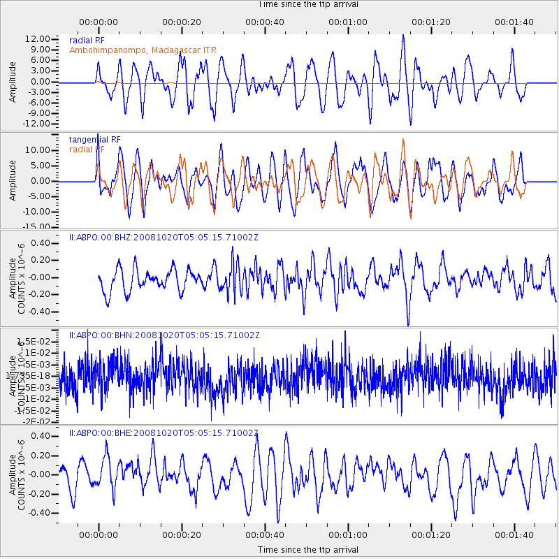
ABPO Ambohimpanompo, Madagascar - Earthquake Result Viewer
*The percent match for this event was below the threshold and hence no stack was calculated.
| Earthquake location: |
Minahassa Peninsula, Sulawesi |
| Earthquake latitude/longitude: |
0.1/120.7 |
| Earthquake time(UTC): |
2008/10/20 (294) 04:54:19 GMT |
| Earthquake Depth: |
102 km |
| Earthquake Magnitude: |
6.1 MB, 5.9 MW, 5.8 MW |
| Earthquake Catalog/Contributor: |
WHDF/NEIC |
|
| Network: |
II Global Seismograph Network (GSN - IRIS/IDA) |
| Station: |
ABPO Ambohimpanompo, Madagascar |
| Lat/Lon: |
19.02 S/47.23 E |
| Elevation: |
1528 m |
|
| Distance: |
74.4 deg |
| Az: |
250.317 deg |
| Baz: |
84.4 deg |
| Ray Param: |
$rayparam |
*The percent match for this event was below the threshold and hence was not used in the summary stack. |
|
| Radial Match: |
52.772514 % |
| Radial Bump: |
400 |
| Transverse Match: |
44.43546 % |
| Transverse Bump: |
400 |
| SOD ConfigId: |
2556 |
| Insert Time: |
2010-03-01 21:16:08.704 +0000 |
| GWidth: |
2.5 |
| Max Bumps: |
400 |
| Tol: |
0.001 |
|
Signal To Noise
| Channel | StoN | STA | LTA |
| II:ABPO:00:BHN:20081020T05:05:15.71002Z | 1.0914129 | 7.014762E-9 | 6.4272303E-9 |
| II:ABPO:00:BHE:20081020T05:05:15.71002Z | 1.036039 | 2.0492507E-7 | 1.9779667E-7 |
| II:ABPO:00:BHZ:20081020T05:05:15.71002Z | 1.3217808 | 1.6645002E-7 | 1.2592862E-7 |
| Arrivals |
| Ps | |
| PpPs | |
| PsPs/PpSs | |


