You are here: Home > Network List > TA - USArray Transportable Network (new EarthScope stations) Stations List
> Station G59A Clarenceville, QC, USA > Earthquake Result Viewer
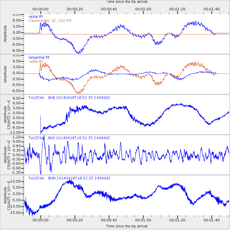
G59A Clarenceville, QC, USA - Earthquake Result Viewer
*The percent match for this event was below the threshold and hence no stack was calculated.
| Earthquake location: |
Northern Alaska |
| Earthquake latitude/longitude: |
67.7/-162.5 |
| Earthquake time(UTC): |
2014/04/18 (108) 18:44:17 GMT |
| Earthquake Depth: |
1.0 km |
| Earthquake Magnitude: |
5.5 MB, 5.4 MI |
| Earthquake Catalog/Contributor: |
NEIC PDE/NEIC COMCAT |
|
| Network: |
TA USArray Transportable Network (new EarthScope stations) |
| Station: |
G59A Clarenceville, QC, USA |
| Lat/Lon: |
45.08 N/73.18 W |
| Elevation: |
36 m |
|
| Distance: |
49.0 deg |
| Az: |
69.721 deg |
| Baz: |
329.606 deg |
| Ray Param: |
$rayparam |
*The percent match for this event was below the threshold and hence was not used in the summary stack. |
|
| Radial Match: |
44.462685 % |
| Radial Bump: |
400 |
| Transverse Match: |
25.60892 % |
| Transverse Bump: |
400 |
| SOD ConfigId: |
626651 |
| Insert Time: |
2014-05-02 19:33:58.937 +0000 |
| GWidth: |
2.5 |
| Max Bumps: |
400 |
| Tol: |
0.001 |
|
Signal To Noise
| Channel | StoN | STA | LTA |
| TA:G59A: :BHZ:20140418T18:52:35.249999Z | 2.1061044 | 7.117472E-7 | 3.379449E-7 |
| TA:G59A: :BHN:20140418T18:52:35.249999Z | 1.485396 | 1.6371E-5 | 1.1021302E-5 |
| TA:G59A: :BHE:20140418T18:52:35.249999Z | 1.122965 | 5.5264823E-6 | 4.921331E-6 |
| Arrivals |
| Ps | |
| PpPs | |
| PsPs/PpSs | |


