You are here: Home > Network List > CI - Caltech Regional Seismic Network Stations List
> Station BAR Barrett, Tecate, CA, USA > Earthquake Result Viewer
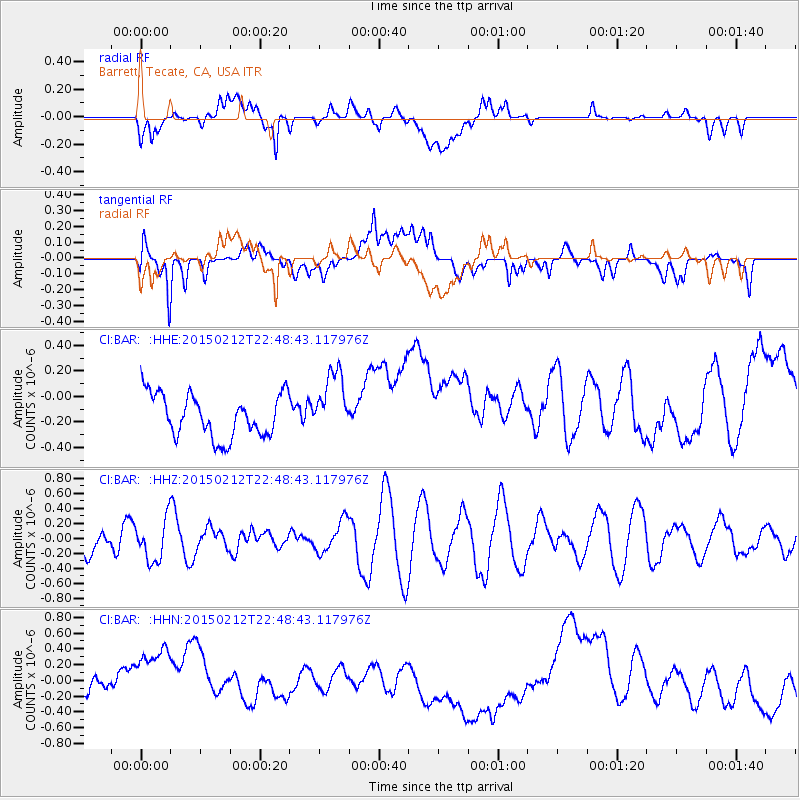
BAR Barrett, Tecate, CA, USA - Earthquake Result Viewer
*The percent match for this event was below the threshold and hence no stack was calculated.
| Earthquake location: |
Kuril Islands |
| Earthquake latitude/longitude: |
44.1/146.4 |
| Earthquake time(UTC): |
2015/02/12 (043) 22:38:02 GMT |
| Earthquake Depth: |
146 km |
| Earthquake Magnitude: |
3.5 mb |
| Earthquake Catalog/Contributor: |
ISC/ISC |
|
| Network: |
CI Caltech Regional Seismic Network |
| Station: |
BAR Barrett, Tecate, CA, USA |
| Lat/Lon: |
32.68 N/116.67 W |
| Elevation: |
521 m |
|
| Distance: |
72.6 deg |
| Az: |
61.315 deg |
| Baz: |
311.436 deg |
| Ray Param: |
$rayparam |
*The percent match for this event was below the threshold and hence was not used in the summary stack. |
|
| Radial Match: |
36.761063 % |
| Radial Bump: |
400 |
| Transverse Match: |
24.88181 % |
| Transverse Bump: |
400 |
| SOD ConfigId: |
7019011 |
| Insert Time: |
2019-04-16 18:41:06.284 +0000 |
| GWidth: |
2.5 |
| Max Bumps: |
400 |
| Tol: |
0.001 |
|
Signal To Noise
| Channel | StoN | STA | LTA |
| CI:BAR: :HHZ:20150212T22:48:43.117976Z | 0.82375485 | 2.7674238E-7 | 3.3595234E-7 |
| CI:BAR: :HHN:20150212T22:48:43.117976Z | 3.0570076 | 5.646648E-7 | 1.847116E-7 |
| CI:BAR: :HHE:20150212T22:48:43.117976Z | 1.516234 | 2.5330056E-7 | 1.6705901E-7 |
| Arrivals |
| Ps | |
| PpPs | |
| PsPs/PpSs | |


