You are here: Home > Network List > TA - USArray Transportable Network (new EarthScope stations) Stations List
> Station I45A Fountain, MI, USA > Earthquake Result Viewer
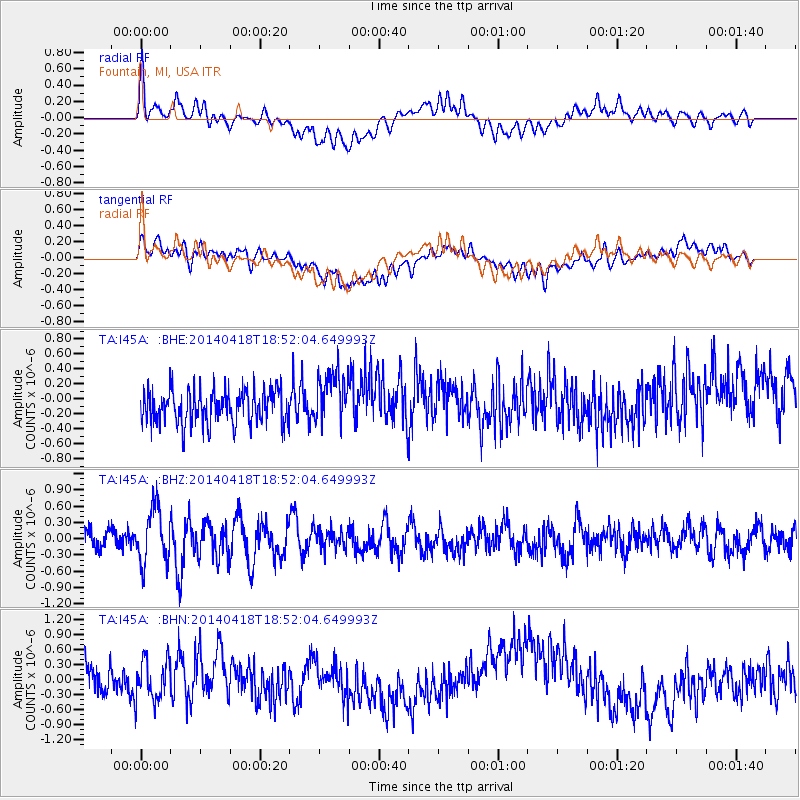
I45A Fountain, MI, USA - Earthquake Result Viewer
*The percent match for this event was below the threshold and hence no stack was calculated.
| Earthquake location: |
Northern Alaska |
| Earthquake latitude/longitude: |
67.7/-162.5 |
| Earthquake time(UTC): |
2014/04/18 (108) 18:44:17 GMT |
| Earthquake Depth: |
1.0 km |
| Earthquake Magnitude: |
5.5 MB, 5.4 MI |
| Earthquake Catalog/Contributor: |
NEIC PDE/NEIC COMCAT |
|
| Network: |
TA USArray Transportable Network (new EarthScope stations) |
| Station: |
I45A Fountain, MI, USA |
| Lat/Lon: |
44.04 N/86.23 W |
| Elevation: |
215 m |
|
| Distance: |
45.1 deg |
| Az: |
81.371 deg |
| Baz: |
328.409 deg |
| Ray Param: |
$rayparam |
*The percent match for this event was below the threshold and hence was not used in the summary stack. |
|
| Radial Match: |
46.508015 % |
| Radial Bump: |
400 |
| Transverse Match: |
43.205795 % |
| Transverse Bump: |
400 |
| SOD ConfigId: |
626651 |
| Insert Time: |
2014-05-02 19:34:57.656 +0000 |
| GWidth: |
2.5 |
| Max Bumps: |
400 |
| Tol: |
0.001 |
|
Signal To Noise
| Channel | StoN | STA | LTA |
| TA:I45A: :BHZ:20140418T18:52:04.649993Z | 2.5074396 | 4.9601636E-7 | 1.9781787E-7 |
| TA:I45A: :BHN:20140418T18:52:04.649993Z | 1.157135 | 4.1192206E-7 | 3.559844E-7 |
| TA:I45A: :BHE:20140418T18:52:04.649993Z | 1.5432822 | 3.4865465E-7 | 2.2591763E-7 |
| Arrivals |
| Ps | |
| PpPs | |
| PsPs/PpSs | |


