You are here: Home > Network List > GS - US Geological Survey Networks Stations List
> Station KAN10 Keim Farm > Earthquake Result Viewer
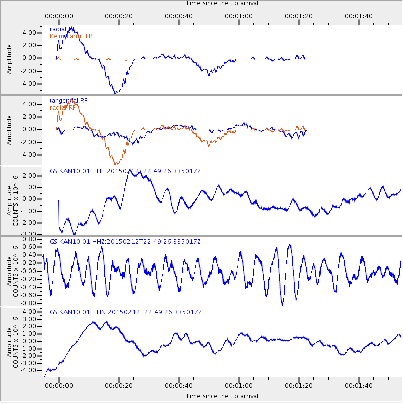
KAN10 Keim Farm - Earthquake Result Viewer
*The percent match for this event was below the threshold and hence no stack was calculated.
| Earthquake location: |
Kuril Islands |
| Earthquake latitude/longitude: |
44.1/146.4 |
| Earthquake time(UTC): |
2015/02/12 (043) 22:38:02 GMT |
| Earthquake Depth: |
146 km |
| Earthquake Magnitude: |
3.5 mb |
| Earthquake Catalog/Contributor: |
ISC/ISC |
|
| Network: |
GS US Geological Survey Networks |
| Station: |
KAN10 Keim Farm |
| Lat/Lon: |
37.12 N/98.10 W |
| Elevation: |
417 m |
|
| Distance: |
80.3 deg |
| Az: |
47.029 deg |
| Baz: |
318.718 deg |
| Ray Param: |
$rayparam |
*The percent match for this event was below the threshold and hence was not used in the summary stack. |
|
| Radial Match: |
69.1702 % |
| Radial Bump: |
400 |
| Transverse Match: |
36.345886 % |
| Transverse Bump: |
400 |
| SOD ConfigId: |
7019011 |
| Insert Time: |
2019-04-16 18:42:29.386 +0000 |
| GWidth: |
2.5 |
| Max Bumps: |
400 |
| Tol: |
0.001 |
|
Signal To Noise
| Channel | StoN | STA | LTA |
| GS:KAN10:01:HHZ:20150212T22:49:26.335017Z | 0.90300846 | 3.1654454E-7 | 3.5054438E-7 |
| GS:KAN10:01:HHN:20150212T22:49:26.335017Z | 1.4362444 | 3.0372712E-6 | 2.1147314E-6 |
| GS:KAN10:01:HHE:20150212T22:49:26.335017Z | 1.3729973 | 1.975464E-6 | 1.4387969E-6 |
| Arrivals |
| Ps | |
| PpPs | |
| PsPs/PpSs | |


