You are here: Home > Network List > TA - USArray Transportable Network (new EarthScope stations) Stations List
> Station O48A Farmland, IN, USA > Earthquake Result Viewer
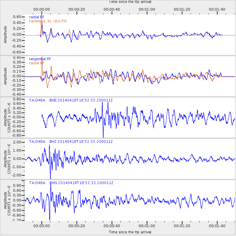
O48A Farmland, IN, USA - Earthquake Result Viewer
*The percent match for this event was below the threshold and hence no stack was calculated.
| Earthquake location: |
Northern Alaska |
| Earthquake latitude/longitude: |
67.7/-162.5 |
| Earthquake time(UTC): |
2014/04/18 (108) 18:44:17 GMT |
| Earthquake Depth: |
1.0 km |
| Earthquake Magnitude: |
5.5 MB, 5.4 MI |
| Earthquake Catalog/Contributor: |
NEIC PDE/NEIC COMCAT |
|
| Network: |
TA USArray Transportable Network (new EarthScope stations) |
| Station: |
O48A Farmland, IN, USA |
| Lat/Lon: |
40.26 N/85.16 W |
| Elevation: |
300 m |
|
| Distance: |
48.8 deg |
| Az: |
83.06 deg |
| Baz: |
330.285 deg |
| Ray Param: |
$rayparam |
*The percent match for this event was below the threshold and hence was not used in the summary stack. |
|
| Radial Match: |
59.539455 % |
| Radial Bump: |
400 |
| Transverse Match: |
64.02961 % |
| Transverse Bump: |
400 |
| SOD ConfigId: |
626651 |
| Insert Time: |
2014-05-02 19:39:51.863 +0000 |
| GWidth: |
2.5 |
| Max Bumps: |
400 |
| Tol: |
0.001 |
|
Signal To Noise
| Channel | StoN | STA | LTA |
| TA:O48A: :BHZ:20140418T18:52:33.200011Z | 4.5149045 | 7.2002956E-7 | 1.5947838E-7 |
| TA:O48A: :BHN:20140418T18:52:33.200011Z | 3.262329 | 4.1029642E-7 | 1.2576795E-7 |
| TA:O48A: :BHE:20140418T18:52:33.200011Z | 1.5035844 | 2.1699584E-7 | 1.4431903E-7 |
| Arrivals |
| Ps | |
| PpPs | |
| PsPs/PpSs | |


