You are here: Home > Network List > TA - USArray Transportable Network (new EarthScope stations) Stations List
> Station L59A Walton, NY, USA > Earthquake Result Viewer
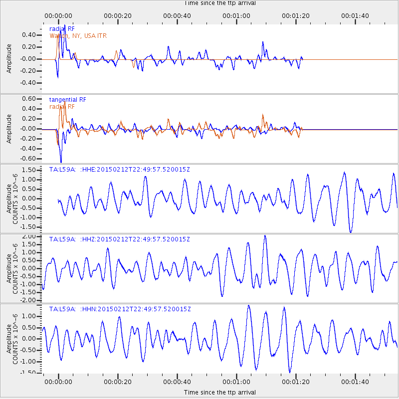
L59A Walton, NY, USA - Earthquake Result Viewer
*The percent match for this event was below the threshold and hence no stack was calculated.
| Earthquake location: |
Kuril Islands |
| Earthquake latitude/longitude: |
44.1/146.4 |
| Earthquake time(UTC): |
2015/02/12 (043) 22:38:02 GMT |
| Earthquake Depth: |
146 km |
| Earthquake Magnitude: |
3.5 mb |
| Earthquake Catalog/Contributor: |
ISC/ISC |
|
| Network: |
TA USArray Transportable Network (new EarthScope stations) |
| Station: |
L59A Walton, NY, USA |
| Lat/Lon: |
42.19 N/75.04 W |
| Elevation: |
677 m |
|
| Distance: |
86.4 deg |
| Az: |
29.512 deg |
| Baz: |
331.463 deg |
| Ray Param: |
$rayparam |
*The percent match for this event was below the threshold and hence was not used in the summary stack. |
|
| Radial Match: |
66.652985 % |
| Radial Bump: |
400 |
| Transverse Match: |
67.16002 % |
| Transverse Bump: |
388 |
| SOD ConfigId: |
7019011 |
| Insert Time: |
2019-04-16 18:45:41.653 +0000 |
| GWidth: |
2.5 |
| Max Bumps: |
400 |
| Tol: |
0.001 |
|
Signal To Noise
| Channel | StoN | STA | LTA |
| TA:L59A: :HHZ:20150212T22:49:57.520015Z | 0.8033276 | 4.1160388E-7 | 5.123736E-7 |
| TA:L59A: :HHN:20150212T22:49:57.520015Z | 1.0370286 | 4.853054E-7 | 4.6797692E-7 |
| TA:L59A: :HHE:20150212T22:49:57.520015Z | 1.609354 | 6.7873066E-7 | 4.2174105E-7 |
| Arrivals |
| Ps | |
| PpPs | |
| PsPs/PpSs | |


