You are here: Home > Network List > US - United States National Seismic Network Stations List
> Station HAWA Hanford, Washington, USA > Earthquake Result Viewer
HAWA Hanford, Washington, USA - Earthquake Result Viewer
*The percent match for this event was below the threshold and hence no stack was calculated.
| Earthquake location: |
Kuril Islands |
| Earthquake latitude/longitude: |
44.1/146.4 |
| Earthquake time(UTC): |
2015/02/12 (043) 22:38:02 GMT |
| Earthquake Depth: |
146 km |
| Earthquake Magnitude: |
3.5 mb |
| Earthquake Catalog/Contributor: |
ISC/ISC |
|
| Network: |
US United States National Seismic Network |
| Station: |
HAWA Hanford, Washington, USA |
| Lat/Lon: |
46.39 N/119.53 W |
| Elevation: |
364 m |
|
| Distance: |
62.3 deg |
| Az: |
51.234 deg |
| Baz: |
305.719 deg |
| Ray Param: |
$rayparam |
*The percent match for this event was below the threshold and hence was not used in the summary stack. |
|
| Radial Match: |
57.104645 % |
| Radial Bump: |
400 |
| Transverse Match: |
56.61006 % |
| Transverse Bump: |
400 |
| SOD ConfigId: |
7019011 |
| Insert Time: |
2019-04-16 18:46:38.042 +0000 |
| GWidth: |
2.5 |
| Max Bumps: |
400 |
| Tol: |
0.001 |
|
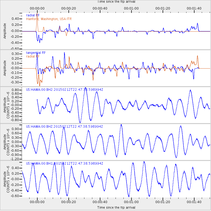
Signal To Noise
| Channel | StoN | STA | LTA |
| US:HAWA:00:BHZ:20150212T22:47:38.598994Z | 1.0437425 | 4.6277503E-7 | 4.4338043E-7 |
| US:HAWA:00:BH1:20150212T22:47:38.598994Z | 0.87672514 | 2.6134632E-7 | 2.980938E-7 |
| US:HAWA:00:BH2:20150212T22:47:38.598994Z | 2.3501115 | 6.3755715E-7 | 2.7128803E-7 |
| Arrivals |
| Ps | |
| PpPs | |
| PsPs/PpSs | |


