You are here: Home > Network List > US - United States National Seismic Network Stations List
> Station MNTX Cornudas Mountains, Texas, USA > Earthquake Result Viewer
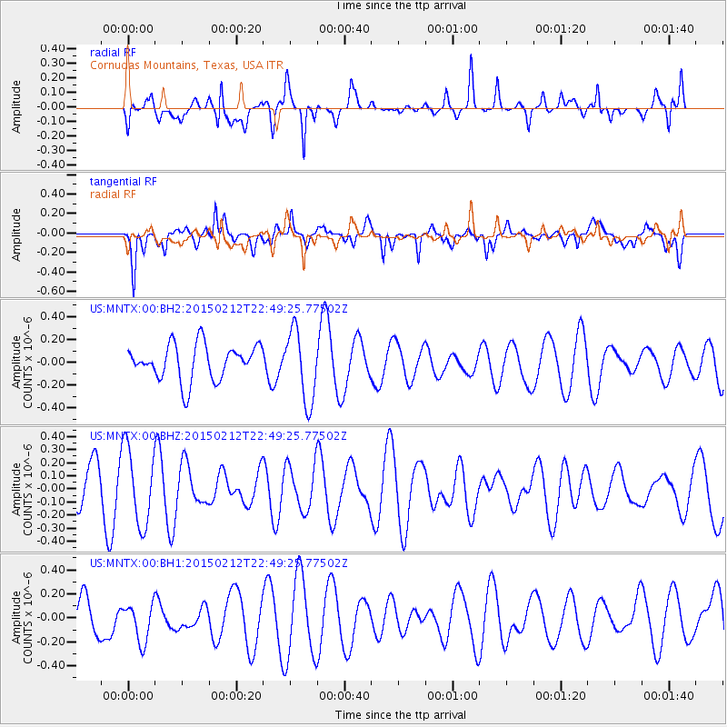
MNTX Cornudas Mountains, Texas, USA - Earthquake Result Viewer
*The percent match for this event was below the threshold and hence no stack was calculated.
| Earthquake location: |
Kuril Islands |
| Earthquake latitude/longitude: |
44.1/146.4 |
| Earthquake time(UTC): |
2015/02/12 (043) 22:38:02 GMT |
| Earthquake Depth: |
146 km |
| Earthquake Magnitude: |
3.5 mb |
| Earthquake Catalog/Contributor: |
ISC/ISC |
|
| Network: |
US United States National Seismic Network |
| Station: |
MNTX Cornudas Mountains, Texas, USA |
| Lat/Lon: |
31.70 N/105.38 W |
| Elevation: |
404 m |
|
| Distance: |
80.2 deg |
| Az: |
55.241 deg |
| Baz: |
316.003 deg |
| Ray Param: |
$rayparam |
*The percent match for this event was below the threshold and hence was not used in the summary stack. |
|
| Radial Match: |
69.52199 % |
| Radial Bump: |
398 |
| Transverse Match: |
68.77217 % |
| Transverse Bump: |
400 |
| SOD ConfigId: |
7019011 |
| Insert Time: |
2019-04-16 18:46:41.372 +0000 |
| GWidth: |
2.5 |
| Max Bumps: |
400 |
| Tol: |
0.001 |
|
Signal To Noise
| Channel | StoN | STA | LTA |
| US:MNTX:00:BHZ:20150212T22:49:25.77502Z | 1.7727207 | 2.9220413E-7 | 1.6483371E-7 |
| US:MNTX:00:BH1:20150212T22:49:25.77502Z | 1.1899655 | 1.657823E-7 | 1.393169E-7 |
| US:MNTX:00:BH2:20150212T22:49:25.77502Z | 2.0547326 | 3.1718028E-7 | 1.5436572E-7 |
| Arrivals |
| Ps | |
| PpPs | |
| PsPs/PpSs | |


