You are here: Home > Network List > UW - Pacific Northwest Regional Seismic Network Stations List
> Station UMAT Pilot Rock, OR, USA > Earthquake Result Viewer
UMAT Pilot Rock, OR, USA - Earthquake Result Viewer
*The percent match for this event was below the threshold and hence no stack was calculated.
| Earthquake location: |
Kuril Islands |
| Earthquake latitude/longitude: |
44.1/146.4 |
| Earthquake time(UTC): |
2015/02/12 (043) 22:38:02 GMT |
| Earthquake Depth: |
146 km |
| Earthquake Magnitude: |
3.5 mb |
| Earthquake Catalog/Contributor: |
ISC/ISC |
|
| Network: |
UW Pacific Northwest Regional Seismic Network |
| Station: |
UMAT Pilot Rock, OR, USA |
| Lat/Lon: |
45.29 N/118.96 W |
| Elevation: |
1318 m |
|
| Distance: |
63.3 deg |
| Az: |
51.971 deg |
| Baz: |
306.465 deg |
| Ray Param: |
$rayparam |
*The percent match for this event was below the threshold and hence was not used in the summary stack. |
|
| Radial Match: |
62.232487 % |
| Radial Bump: |
373 |
| Transverse Match: |
42.2038 % |
| Transverse Bump: |
400 |
| SOD ConfigId: |
7019011 |
| Insert Time: |
2019-04-16 18:47:00.421 +0000 |
| GWidth: |
2.5 |
| Max Bumps: |
400 |
| Tol: |
0.001 |
|
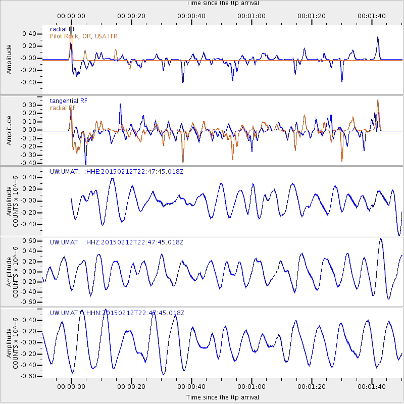
Signal To Noise
| Channel | StoN | STA | LTA |
| UW:UMAT: :HHZ:20150212T22:47:45.018Z | 1.1603355 | 2.0532586E-7 | 1.7695386E-7 |
| UW:UMAT: :HHN:20150212T22:47:45.018Z | 2.7670767 | 4.2457583E-7 | 1.534384E-7 |
| UW:UMAT: :HHE:20150212T22:47:45.018Z | 0.14334482 | 2.885647E-8 | 2.0130807E-7 |
| Arrivals |
| Ps | |
| PpPs | |
| PsPs/PpSs | |


