You are here: Home > Network List > US - United States National Seismic Network Stations List
> Station LAO LASA Array, Montana, USA > Earthquake Result Viewer
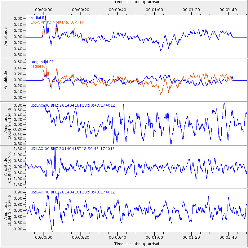
LAO LASA Array, Montana, USA - Earthquake Result Viewer
*The percent match for this event was below the threshold and hence no stack was calculated.
| Earthquake location: |
Northern Alaska |
| Earthquake latitude/longitude: |
67.7/-162.5 |
| Earthquake time(UTC): |
2014/04/18 (108) 18:44:17 GMT |
| Earthquake Depth: |
1.0 km |
| Earthquake Magnitude: |
5.5 MB, 5.4 MI |
| Earthquake Catalog/Contributor: |
NEIC PDE/NEIC COMCAT |
|
| Network: |
US United States National Seismic Network |
| Station: |
LAO LASA Array, Montana, USA |
| Lat/Lon: |
46.69 N/106.22 W |
| Elevation: |
902 m |
|
| Distance: |
35.3 deg |
| Az: |
97.574 deg |
| Baz: |
326.614 deg |
| Ray Param: |
$rayparam |
*The percent match for this event was below the threshold and hence was not used in the summary stack. |
|
| Radial Match: |
63.921005 % |
| Radial Bump: |
400 |
| Transverse Match: |
46.034668 % |
| Transverse Bump: |
400 |
| SOD ConfigId: |
626651 |
| Insert Time: |
2014-05-02 19:46:34.244 +0000 |
| GWidth: |
2.5 |
| Max Bumps: |
400 |
| Tol: |
0.001 |
|
Signal To Noise
| Channel | StoN | STA | LTA |
| US:LAO:00:BHZ:20140418T18:50:43.17401Z | 2.5939753 | 4.9658377E-7 | 1.9143734E-7 |
| US:LAO:00:BH1:20140418T18:50:43.17401Z | 1.7100346 | 5.193929E-7 | 3.037324E-7 |
| US:LAO:00:BH2:20140418T18:50:43.17401Z | 1.2505252 | 3.5950217E-7 | 2.8748093E-7 |
| Arrivals |
| Ps | |
| PpPs | |
| PsPs/PpSs | |


