You are here: Home > Network List > UW - Pacific Northwest Regional Seismic Network Stations List
> Station UMAT Pilot Rock, OR, USA > Earthquake Result Viewer
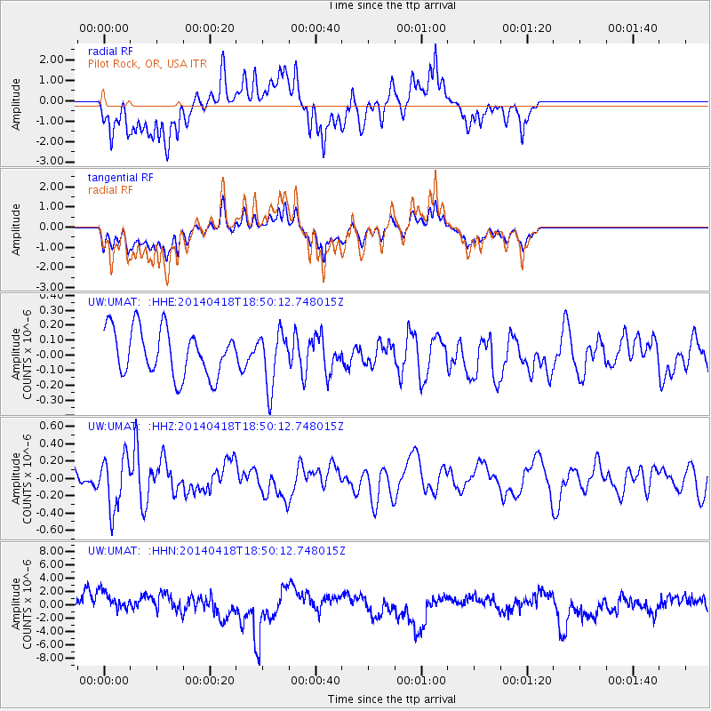
UMAT Pilot Rock, OR, USA - Earthquake Result Viewer
*The percent match for this event was below the threshold and hence no stack was calculated.
| Earthquake location: |
Northern Alaska |
| Earthquake latitude/longitude: |
67.7/-162.5 |
| Earthquake time(UTC): |
2014/04/18 (108) 18:44:17 GMT |
| Earthquake Depth: |
1.0 km |
| Earthquake Magnitude: |
5.5 MB, 5.4 MI |
| Earthquake Catalog/Contributor: |
NEIC PDE/NEIC COMCAT |
|
| Network: |
UW Pacific Northwest Regional Seismic Network |
| Station: |
UMAT Pilot Rock, OR, USA |
| Lat/Lon: |
45.29 N/118.96 W |
| Elevation: |
1318 m |
|
| Distance: |
31.8 deg |
| Az: |
112.592 deg |
| Baz: |
330.012 deg |
| Ray Param: |
$rayparam |
*The percent match for this event was below the threshold and hence was not used in the summary stack. |
|
| Radial Match: |
51.07499 % |
| Radial Bump: |
345 |
| Transverse Match: |
51.134422 % |
| Transverse Bump: |
391 |
| SOD ConfigId: |
626651 |
| Insert Time: |
2014-05-02 19:49:49.411 +0000 |
| GWidth: |
2.5 |
| Max Bumps: |
400 |
| Tol: |
0.001 |
|
Signal To Noise
| Channel | StoN | STA | LTA |
| UW:UMAT: :HHZ:20140418T18:50:12.748015Z | 2.276354 | 2.9871674E-7 | 1.3122596E-7 |
| UW:UMAT: :HHN:20140418T18:50:12.748015Z | 1.1375829 | 1.8529571E-6 | 1.6288545E-6 |
| UW:UMAT: :HHE:20140418T18:50:12.748015Z | 1.1797906 | 1.8271894E-7 | 1.5487403E-7 |
| Arrivals |
| Ps | |
| PpPs | |
| PsPs/PpSs | |


