You are here: Home > Network List > UW - Pacific Northwest Regional Seismic Network Stations List
> Station UMAT Pilot Rock, OR, USA > Earthquake Result Viewer
UMAT Pilot Rock, OR, USA - Earthquake Result Viewer
*The percent match for this event was below the threshold and hence no stack was calculated.
| Earthquake location: |
Bismarck Sea |
| Earthquake latitude/longitude: |
-3.5/149.0 |
| Earthquake time(UTC): |
2015/02/13 (044) 17:02:07 GMT |
| Earthquake Depth: |
19 km |
| Earthquake Magnitude: |
5.5 MW |
| Earthquake Catalog/Contributor: |
ISC/ISC |
|
| Network: |
UW Pacific Northwest Regional Seismic Network |
| Station: |
UMAT Pilot Rock, OR, USA |
| Lat/Lon: |
45.29 N/118.96 W |
| Elevation: |
1318 m |
|
| Distance: |
93.9 deg |
| Az: |
44.997 deg |
| Baz: |
269.049 deg |
| Ray Param: |
$rayparam |
*The percent match for this event was below the threshold and hence was not used in the summary stack. |
|
| Radial Match: |
45.661327 % |
| Radial Bump: |
400 |
| Transverse Match: |
45.38756 % |
| Transverse Bump: |
400 |
| SOD ConfigId: |
7019011 |
| Insert Time: |
2019-04-16 19:00:24.595 +0000 |
| GWidth: |
2.5 |
| Max Bumps: |
400 |
| Tol: |
0.001 |
|
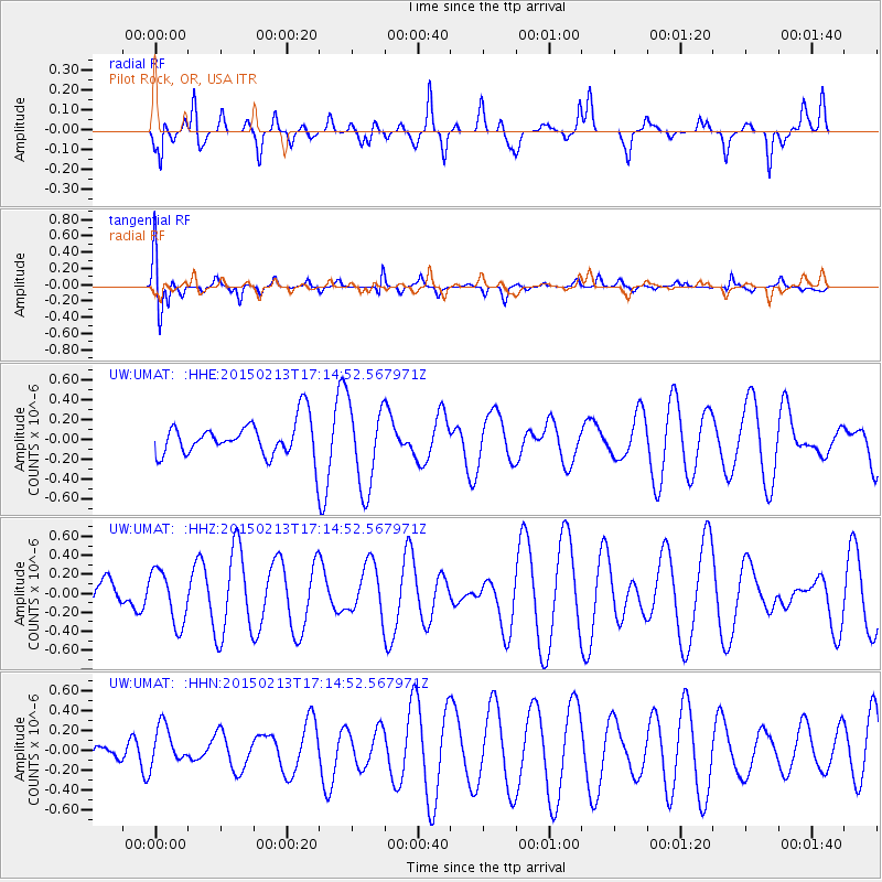
Signal To Noise
| Channel | StoN | STA | LTA |
| UW:UMAT: :HHZ:20150213T17:14:52.567971Z | 0.8325142 | 2.8177533E-7 | 3.3846308E-7 |
| UW:UMAT: :HHN:20150213T17:14:52.567971Z | 0.75261676 | 1.9316256E-7 | 2.566546E-7 |
| UW:UMAT: :HHE:20150213T17:14:52.567971Z | 2.4397068 | 4.27349E-7 | 1.7516408E-7 |
| Arrivals |
| Ps | |
| PpPs | |
| PsPs/PpSs | |


