You are here: Home > Network List > UW - Pacific Northwest Regional Seismic Network Stations List
> Station LEBA Lebam, WA, USA > Earthquake Result Viewer
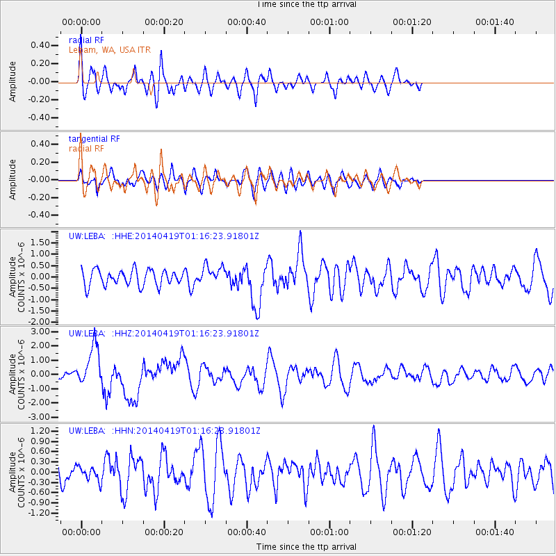
LEBA Lebam, WA, USA - Earthquake Result Viewer
*The percent match for this event was below the threshold and hence no stack was calculated.
| Earthquake location: |
Solomon Islands |
| Earthquake latitude/longitude: |
-6.7/155.1 |
| Earthquake time(UTC): |
2014/04/19 (109) 01:04:03 GMT |
| Earthquake Depth: |
24 km |
| Earthquake Magnitude: |
6.6 MWB, 6.9 MI, 7.0 MI |
| Earthquake Catalog/Contributor: |
NEIC PDE/NEIC COMCAT |
|
| Network: |
UW Pacific Northwest Regional Seismic Network |
| Station: |
LEBA Lebam, WA, USA |
| Lat/Lon: |
46.55 N/123.56 W |
| Elevation: |
73 m |
|
| Distance: |
88.9 deg |
| Az: |
43.038 deg |
| Baz: |
259.172 deg |
| Ray Param: |
$rayparam |
*The percent match for this event was below the threshold and hence was not used in the summary stack. |
|
| Radial Match: |
62.192406 % |
| Radial Bump: |
400 |
| Transverse Match: |
58.975212 % |
| Transverse Bump: |
400 |
| SOD ConfigId: |
626651 |
| Insert Time: |
2014-05-03 01:34:13.120 +0000 |
| GWidth: |
2.5 |
| Max Bumps: |
400 |
| Tol: |
0.001 |
|
Signal To Noise
| Channel | StoN | STA | LTA |
| UW:LEBA: :HHZ:20140419T01:16:23.91801Z | 5.8356533 | 1.4467971E-6 | 2.4792374E-7 |
| UW:LEBA: :HHN:20140419T01:16:23.91801Z | 0.7377987 | 2.047195E-7 | 2.774734E-7 |
| UW:LEBA: :HHE:20140419T01:16:23.91801Z | 1.2306526 | 4.2521668E-7 | 3.4552133E-7 |
| Arrivals |
| Ps | |
| PpPs | |
| PsPs/PpSs | |


