You are here: Home > Network List > US - United States National Seismic Network Stations List
> Station BW06 Boulder Array Site 6 (Pinedale), Wyoming, USA > Earthquake Result Viewer
BW06 Boulder Array Site 6 (Pinedale), Wyoming, USA - Earthquake Result Viewer
*The percent match for this event was below the threshold and hence no stack was calculated.
| Earthquake location: |
Northern Mid-Atlantic Ridge |
| Earthquake latitude/longitude: |
52.6/-32.0 |
| Earthquake time(UTC): |
2015/02/13 (044) 18:48:17 GMT |
| Earthquake Depth: |
12 km |
| Earthquake Magnitude: |
5.7 MW |
| Earthquake Catalog/Contributor: |
ISC/ISC |
|
| Network: |
US United States National Seismic Network |
| Station: |
BW06 Boulder Array Site 6 (Pinedale), Wyoming, USA |
| Lat/Lon: |
42.77 N/109.56 W |
| Elevation: |
2224 m |
|
| Distance: |
50.7 deg |
| Az: |
291.745 deg |
| Baz: |
50.233 deg |
| Ray Param: |
$rayparam |
*The percent match for this event was below the threshold and hence was not used in the summary stack. |
|
| Radial Match: |
72.26623 % |
| Radial Bump: |
400 |
| Transverse Match: |
62.76577 % |
| Transverse Bump: |
400 |
| SOD ConfigId: |
7019011 |
| Insert Time: |
2019-04-16 19:08:51.553 +0000 |
| GWidth: |
2.5 |
| Max Bumps: |
400 |
| Tol: |
0.001 |
|
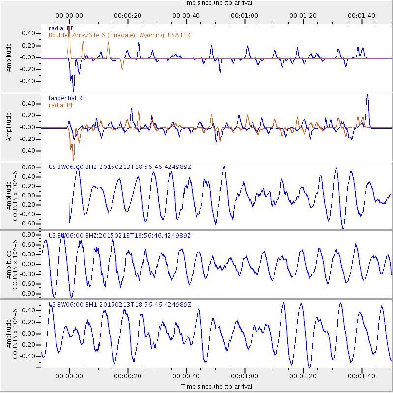
Signal To Noise
| Channel | StoN | STA | LTA |
| US:BW06:00:BHZ:20150213T18:56:46.424989Z | 1.7033143 | 6.1788904E-7 | 3.627569E-7 |
| US:BW06:00:BH1:20150213T18:56:46.424989Z | 0.4046244 | 9.385096E-8 | 2.3194586E-7 |
| US:BW06:00:BH2:20150213T18:56:46.424989Z | 1.3149853 | 3.6014458E-7 | 2.7387728E-7 |
| Arrivals |
| Ps | |
| PpPs | |
| PsPs/PpSs | |


