You are here: Home > Network List > UW - Pacific Northwest Regional Seismic Network Stations List
> Station MRBL Marblemount, WA, USA > Earthquake Result Viewer
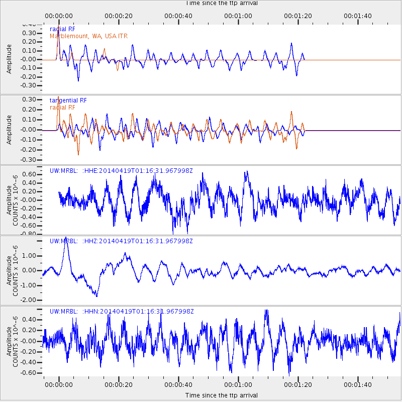
MRBL Marblemount, WA, USA - Earthquake Result Viewer
*The percent match for this event was below the threshold and hence no stack was calculated.
| Earthquake location: |
Solomon Islands |
| Earthquake latitude/longitude: |
-6.7/155.1 |
| Earthquake time(UTC): |
2014/04/19 (109) 01:04:03 GMT |
| Earthquake Depth: |
24 km |
| Earthquake Magnitude: |
6.6 MWB, 6.9 MI, 7.0 MI |
| Earthquake Catalog/Contributor: |
NEIC PDE/NEIC COMCAT |
|
| Network: |
UW Pacific Northwest Regional Seismic Network |
| Station: |
MRBL Marblemount, WA, USA |
| Lat/Lon: |
48.52 N/121.48 W |
| Elevation: |
75 m |
|
| Distance: |
90.6 deg |
| Az: |
41.342 deg |
| Baz: |
260.694 deg |
| Ray Param: |
$rayparam |
*The percent match for this event was below the threshold and hence was not used in the summary stack. |
|
| Radial Match: |
76.8861 % |
| Radial Bump: |
400 |
| Transverse Match: |
70.74693 % |
| Transverse Bump: |
400 |
| SOD ConfigId: |
626651 |
| Insert Time: |
2014-05-03 01:34:30.101 +0000 |
| GWidth: |
2.5 |
| Max Bumps: |
400 |
| Tol: |
0.001 |
|
Signal To Noise
| Channel | StoN | STA | LTA |
| UW:MRBL: :HHZ:20140419T01:16:31.967998Z | 8.213233 | 1.0625402E-6 | 1.293693E-7 |
| UW:MRBL: :HHN:20140419T01:16:31.967998Z | 0.9287227 | 1.6126988E-7 | 1.7364697E-7 |
| UW:MRBL: :HHE:20140419T01:16:31.967998Z | 1.5543319 | 3.187536E-7 | 2.0507434E-7 |
| Arrivals |
| Ps | |
| PpPs | |
| PsPs/PpSs | |


