You are here: Home > Network List > US - United States National Seismic Network Stations List
> Station WMOK Wichita Mountains, Oklahoma, USA > Earthquake Result Viewer
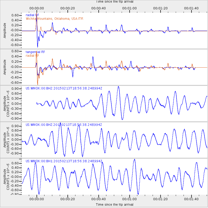
WMOK Wichita Mountains, Oklahoma, USA - Earthquake Result Viewer
*The percent match for this event was below the threshold and hence no stack was calculated.
| Earthquake location: |
Northern Mid-Atlantic Ridge |
| Earthquake latitude/longitude: |
52.6/-32.0 |
| Earthquake time(UTC): |
2015/02/13 (044) 18:48:17 GMT |
| Earthquake Depth: |
12 km |
| Earthquake Magnitude: |
5.7 MW |
| Earthquake Catalog/Contributor: |
ISC/ISC |
|
| Network: |
US United States National Seismic Network |
| Station: |
WMOK Wichita Mountains, Oklahoma, USA |
| Lat/Lon: |
34.74 N/98.78 W |
| Elevation: |
486 m |
|
| Distance: |
49.7 deg |
| Az: |
276.676 deg |
| Baz: |
47.302 deg |
| Ray Param: |
$rayparam |
*The percent match for this event was below the threshold and hence was not used in the summary stack. |
|
| Radial Match: |
72.892815 % |
| Radial Bump: |
400 |
| Transverse Match: |
59.841255 % |
| Transverse Bump: |
400 |
| SOD ConfigId: |
7019011 |
| Insert Time: |
2019-04-16 19:09:00.263 +0000 |
| GWidth: |
2.5 |
| Max Bumps: |
400 |
| Tol: |
0.001 |
|
Signal To Noise
| Channel | StoN | STA | LTA |
| US:WMOK:00:BHZ:20150213T18:56:38.248994Z | 0.4948752 | 1.3194335E-7 | 2.6661948E-7 |
| US:WMOK:00:BH1:20150213T18:56:38.248994Z | 2.1148305 | 4.720157E-7 | 2.2319317E-7 |
| US:WMOK:00:BH2:20150213T18:56:38.248994Z | 0.75701904 | 1.1407359E-7 | 1.5068788E-7 |
| Arrivals |
| Ps | |
| PpPs | |
| PsPs/PpSs | |


