KAPI Kappang, Sulawesi, Indonesia - Earthquake Result Viewer
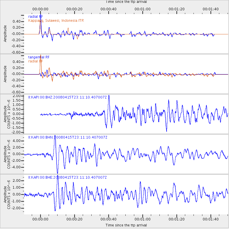
Earthquake location: Andreanof Islands, Aleutian Is.
Earthquake latitude/longitude: 51.9/-179.4
Earthquake time(UTC): 2008/04/15 (106) 22:59:51 GMT
Earthquake Depth: 10 km
Earthquake Magnitude: 6.1 MB, 6.4 MS, 6.4 MW, 6.4 MW
Earthquake Catalog/Contributor: WHDF/NEIC
Network: II Global Seismograph Network (GSN - IRIS/IDA)
Station: KAPI Kappang, Sulawesi, Indonesia
Lat/Lon: 5.01 S/119.75 E
Elevation: 300 m
Distance: 76.6 deg
Az: 243.497 deg
Baz: 33.859 deg
Ray Param: 0.050914735
Estimated Moho Depth: 51.0 km
Estimated Crust Vp/Vs: 1.60
Assumed Crust Vp: 6.343 km/s
Estimated Crust Vs: 3.958 km/s
Estimated Crust Poisson's Ratio: 0.18
Radial Match: 94.445274 %
Radial Bump: 400
Transverse Match: 77.54072 %
Transverse Bump: 400
SOD ConfigId: 2504
Insert Time: 2010-03-01 21:19:57.153 +0000
GWidth: 2.5
Max Bumps: 400
Tol: 0.001

Signal To Noise

ChannelStoNSTALTA
II:KAPI:00:BHN:20080415T23:11:10.407007Z1.92913532.5770424E-71.3358536E-7
II:KAPI:00:BHE:20080415T23:11:10.407007Z2.75959731.7594013E-76.375573E-8
II:KAPI:00:BHZ:20080415T23:11:10.407007Z1.31000421.189483E-79.079994E-8
Arrivals
Ps5.0 SECOND
PpPs20 SECOND
PsPs/PpSs25 SECOND