You are here: Home > Network List > CI - Caltech Regional Seismic Network Stations List
> Station MUR Murrieta > Earthquake Result Viewer
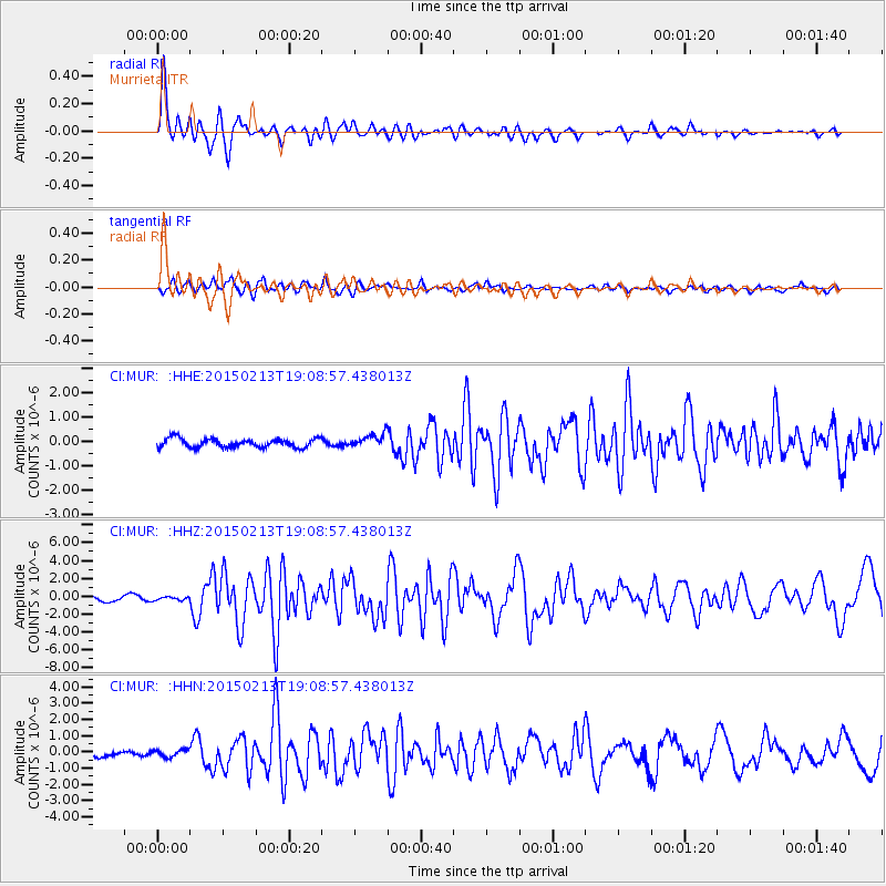
MUR Murrieta - Earthquake Result Viewer
*The percent match for this event was below the threshold and hence no stack was calculated.
| Earthquake location: |
Northern Mid-Atlantic Ridge |
| Earthquake latitude/longitude: |
52.6/-31.9 |
| Earthquake time(UTC): |
2015/02/13 (044) 18:59:12 GMT |
| Earthquake Depth: |
16 km |
| Earthquake Magnitude: |
7.1 MWW, 6.8 MI, 7.0 MWB, 7.0 MWC, 7.1 MWC |
| Earthquake Catalog/Contributor: |
NEIC PDE/NEIC COMCAT |
|
| Network: |
CI Caltech Regional Seismic Network |
| Station: |
MUR Murrieta |
| Lat/Lon: |
33.60 N/117.20 W |
| Elevation: |
562 m |
|
| Distance: |
61.4 deg |
| Az: |
288.703 deg |
| Baz: |
43.761 deg |
| Ray Param: |
$rayparam |
*The percent match for this event was below the threshold and hence was not used in the summary stack. |
|
| Radial Match: |
78.032555 % |
| Radial Bump: |
400 |
| Transverse Match: |
72.4186 % |
| Transverse Bump: |
400 |
| SOD ConfigId: |
7019011 |
| Insert Time: |
2019-04-16 19:24:18.614 +0000 |
| GWidth: |
2.5 |
| Max Bumps: |
400 |
| Tol: |
0.001 |
|
Signal To Noise
| Channel | StoN | STA | LTA |
| CI:MUR: :HHZ:20150213T19:08:57.438013Z | 0.7725425 | 1.9284057E-7 | 2.4961807E-7 |
| CI:MUR: :HHN:20150213T19:08:57.438013Z | 1.8849435 | 2.2621819E-7 | 1.2001325E-7 |
| CI:MUR: :HHE:20150213T19:08:57.438013Z | 1.0769753 | 1.9114965E-7 | 1.774875E-7 |
| Arrivals |
| Ps | |
| PpPs | |
| PsPs/PpSs | |


