You are here: Home > Network List > CN - Canadian National Seismograph Network Stations List
> Station INK INUVIK, NT > Earthquake Result Viewer
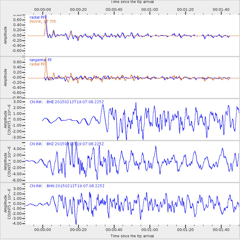
INK INUVIK, NT - Earthquake Result Viewer
*The percent match for this event was below the threshold and hence no stack was calculated.
| Earthquake location: |
Northern Mid-Atlantic Ridge |
| Earthquake latitude/longitude: |
52.6/-31.9 |
| Earthquake time(UTC): |
2015/02/13 (044) 18:59:12 GMT |
| Earthquake Depth: |
16 km |
| Earthquake Magnitude: |
7.1 MWW, 6.8 MI, 7.0 MWB, 7.0 MWC, 7.1 MWC |
| Earthquake Catalog/Contributor: |
NEIC PDE/NEIC COMCAT |
|
| Network: |
CN Canadian National Seismograph Network |
| Station: |
INK INUVIK, NT |
| Lat/Lon: |
68.31 N/133.53 W |
| Elevation: |
44 m |
|
| Distance: |
46.3 deg |
| Az: |
329.784 deg |
| Baz: |
55.586 deg |
| Ray Param: |
$rayparam |
*The percent match for this event was below the threshold and hence was not used in the summary stack. |
|
| Radial Match: |
89.96564 % |
| Radial Bump: |
305 |
| Transverse Match: |
69.97125 % |
| Transverse Bump: |
400 |
| SOD ConfigId: |
7019011 |
| Insert Time: |
2019-04-16 19:24:48.340 +0000 |
| GWidth: |
2.5 |
| Max Bumps: |
400 |
| Tol: |
0.001 |
|
Signal To Noise
| Channel | StoN | STA | LTA |
| CN:INK: :BHZ:20150213T19:07:08.225Z | 3.595964 | 9.650245E-7 | 2.683632E-7 |
| CN:INK: :BHN:20150213T19:07:08.225Z | 1.0485314 | 3.3053817E-7 | 3.1523916E-7 |
| CN:INK: :BHE:20150213T19:07:08.225Z | 2.0723693 | 5.1969187E-7 | 2.5077185E-7 |
| Arrivals |
| Ps | |
| PpPs | |
| PsPs/PpSs | |


