You are here: Home > Network List > CN - Canadian National Seismograph Network Stations List
> Station LLLB Lillooet, BC, CA > Earthquake Result Viewer
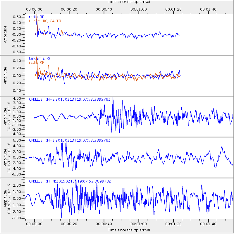
LLLB Lillooet, BC, CA - Earthquake Result Viewer
*The percent match for this event was below the threshold and hence no stack was calculated.
| Earthquake location: |
Northern Mid-Atlantic Ridge |
| Earthquake latitude/longitude: |
52.6/-31.9 |
| Earthquake time(UTC): |
2015/02/13 (044) 18:59:12 GMT |
| Earthquake Depth: |
16 km |
| Earthquake Magnitude: |
7.1 MWW, 6.8 MI, 7.0 MWB, 7.0 MWC, 7.1 MWC |
| Earthquake Catalog/Contributor: |
NEIC PDE/NEIC COMCAT |
|
| Network: |
CN Canadian National Seismograph Network |
| Station: |
LLLB Lillooet, BC, CA |
| Lat/Lon: |
50.61 N/121.88 W |
| Elevation: |
700 m |
|
| Distance: |
52.3 deg |
| Az: |
306.398 deg |
| Baz: |
50.348 deg |
| Ray Param: |
$rayparam |
*The percent match for this event was below the threshold and hence was not used in the summary stack. |
|
| Radial Match: |
69.86074 % |
| Radial Bump: |
400 |
| Transverse Match: |
59.005577 % |
| Transverse Bump: |
400 |
| SOD ConfigId: |
7019011 |
| Insert Time: |
2019-04-16 19:24:50.973 +0000 |
| GWidth: |
2.5 |
| Max Bumps: |
400 |
| Tol: |
0.001 |
|
Signal To Noise
| Channel | StoN | STA | LTA |
| CN:LLLB: :HHZ:20150213T19:07:53.389978Z | 1.6508316 | 7.50823E-7 | 4.5481505E-7 |
| CN:LLLB: :HHN:20150213T19:07:53.389978Z | 1.5539346 | 6.226966E-7 | 4.0072254E-7 |
| CN:LLLB: :HHE:20150213T19:07:53.389978Z | 0.78799427 | 3.2037457E-7 | 4.0656965E-7 |
| Arrivals |
| Ps | |
| PpPs | |
| PsPs/PpSs | |


