You are here: Home > Network List > AV - Alaska Volcano Observatory Stations List
> Station SPCR Ckakachatna River, Mount Spurr, Alaska > Earthquake Result Viewer
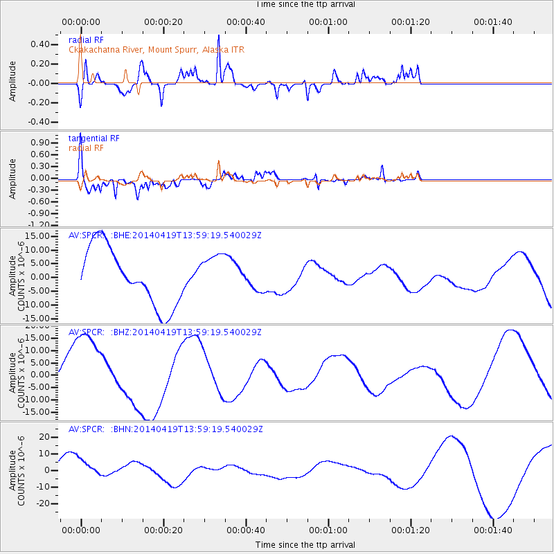
SPCR Ckakachatna River, Mount Spurr, Alaska - Earthquake Result Viewer
*The percent match for this event was below the threshold and hence no stack was calculated.
| Earthquake location: |
Solomon Islands |
| Earthquake latitude/longitude: |
-7.1/154.7 |
| Earthquake time(UTC): |
2014/04/19 (109) 13:47:51 GMT |
| Earthquake Depth: |
72 km |
| Earthquake Magnitude: |
5.6 MB |
| Earthquake Catalog/Contributor: |
NEIC PDE/NEIC COMCAT |
|
| Network: |
AV Alaska Volcano Observatory |
| Station: |
SPCR Ckakachatna River, Mount Spurr, Alaska |
| Lat/Lon: |
61.20 N/152.21 W |
| Elevation: |
984 m |
|
| Distance: |
79.5 deg |
| Az: |
23.177 deg |
| Baz: |
233.768 deg |
| Ray Param: |
$rayparam |
*The percent match for this event was below the threshold and hence was not used in the summary stack. |
|
| Radial Match: |
66.249985 % |
| Radial Bump: |
363 |
| Transverse Match: |
59.32632 % |
| Transverse Bump: |
346 |
| SOD ConfigId: |
626651 |
| Insert Time: |
2014-05-03 14:15:23.972 +0000 |
| GWidth: |
2.5 |
| Max Bumps: |
400 |
| Tol: |
0.001 |
|
Signal To Noise
| Channel | StoN | STA | LTA |
| AV:SPCR: :BHZ:20140419T13:59:19.540029Z | 2.0806944 | 1.6815226E-5 | 8.081544E-6 |
| AV:SPCR: :BHN:20140419T13:59:19.540029Z | 0.32949793 | 5.60478E-6 | 1.7010063E-5 |
| AV:SPCR: :BHE:20140419T13:59:19.540029Z | 0.7165482 | 7.5096946E-6 | 1.0480376E-5 |
| Arrivals |
| Ps | |
| PpPs | |
| PsPs/PpSs | |


