You are here: Home > Network List > TA - USArray Transportable Network (new EarthScope stations) Stations List
> Station J01E Myrtle Point, OR, USA > Earthquake Result Viewer
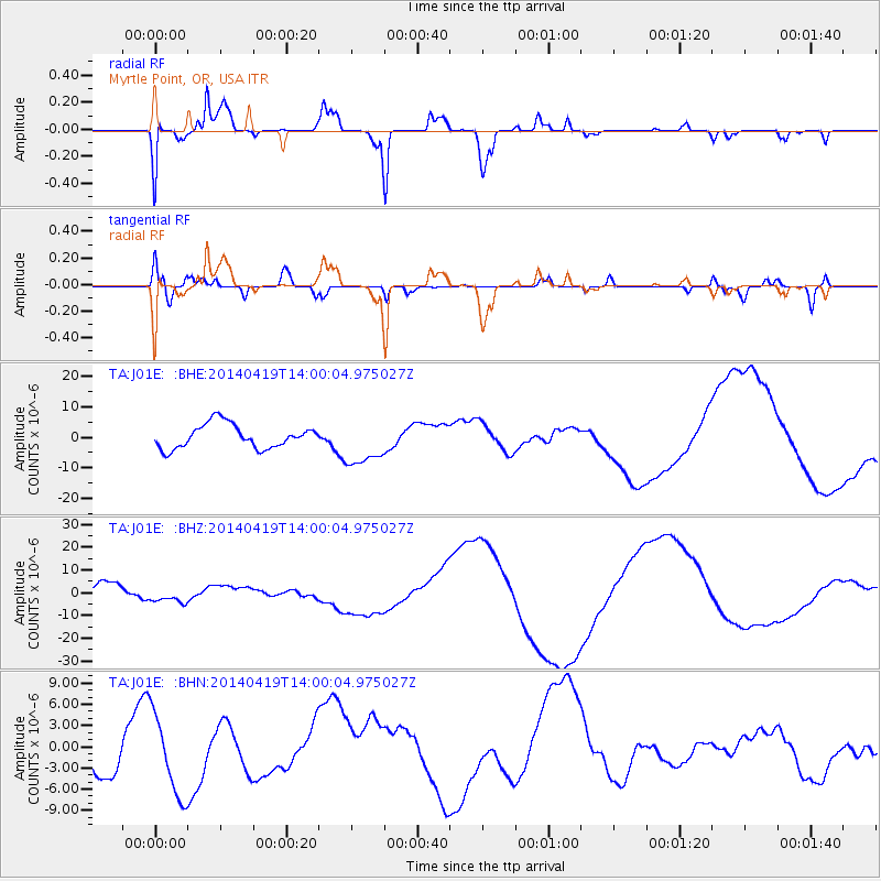
J01E Myrtle Point, OR, USA - Earthquake Result Viewer
*The percent match for this event was below the threshold and hence no stack was calculated.
| Earthquake location: |
Solomon Islands |
| Earthquake latitude/longitude: |
-7.1/154.7 |
| Earthquake time(UTC): |
2014/04/19 (109) 13:47:51 GMT |
| Earthquake Depth: |
72 km |
| Earthquake Magnitude: |
5.6 MB |
| Earthquake Catalog/Contributor: |
NEIC PDE/NEIC COMCAT |
|
| Network: |
TA USArray Transportable Network (new EarthScope stations) |
| Station: |
J01E Myrtle Point, OR, USA |
| Lat/Lon: |
43.16 N/123.93 W |
| Elevation: |
128 m |
|
| Distance: |
88.5 deg |
| Az: |
46.354 deg |
| Baz: |
258.946 deg |
| Ray Param: |
$rayparam |
*The percent match for this event was below the threshold and hence was not used in the summary stack. |
|
| Radial Match: |
87.3222 % |
| Radial Bump: |
318 |
| Transverse Match: |
35.026474 % |
| Transverse Bump: |
400 |
| SOD ConfigId: |
626651 |
| Insert Time: |
2014-05-03 14:21:38.909 +0000 |
| GWidth: |
2.5 |
| Max Bumps: |
400 |
| Tol: |
0.001 |
|
Signal To Noise
| Channel | StoN | STA | LTA |
| TA:J01E: :BHZ:20140419T14:00:04.975027Z | 0.6332918 | 2.3071782E-6 | 3.6431518E-6 |
| TA:J01E: :BHN:20140419T14:00:04.975027Z | 2.5203977 | 5.784476E-6 | 2.2950649E-6 |
| TA:J01E: :BHE:20140419T14:00:04.975027Z | 1.9804155 | 7.751323E-6 | 3.913988E-6 |
| Arrivals |
| Ps | |
| PpPs | |
| PsPs/PpSs | |


