TUPA Temple University, Pennsylvania - Earthquake Result Viewer
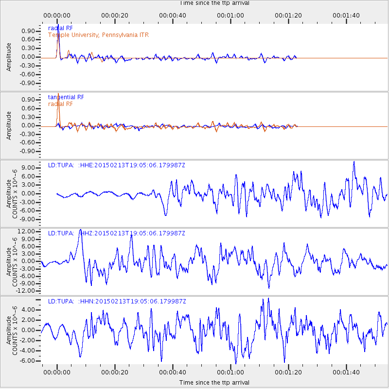
Earthquake location: Northern Mid-Atlantic Ridge
Earthquake latitude/longitude: 52.6/-31.9
Earthquake time(UTC): 2015/02/13 (044) 18:59:12 GMT
Earthquake Depth: 16 km
Earthquake Magnitude: 7.1 MWW, 6.8 MI, 7.0 MWB, 7.0 MWC, 7.1 MWC
Earthquake Catalog/Contributor: NEIC PDE/NEIC COMCAT
Network: LD Lamont-Doherty Cooperative Seismographic Network
Station: TUPA Temple University, Pennsylvania
Lat/Lon: 40.17 N/75.19 W
Elevation: 112 m
Distance: 31.9 deg
Az: 264.504 deg
Baz: 52.341 deg
Ray Param: 0.07888044
Estimated Moho Depth: 45.25 km
Estimated Crust Vp/Vs: 1.74
Assumed Crust Vp: 6.283 km/s
Estimated Crust Vs: 3.606 km/s
Estimated Crust Poisson's Ratio: 0.25
Radial Match: 88.2433 %
Radial Bump: 293
Transverse Match: 71.11882 %
Transverse Bump: 386
SOD ConfigId: 7019011
Insert Time: 2019-04-16 19:26:30.732 +0000
GWidth: 2.5
Max Bumps: 400
Tol: 0.001

Signal To Noise

ChannelStoNSTALTA
LD:TUPA: :HHZ:20150213T19:05:06.179987Z1.58319951.1876202E-67.5013935E-7
LD:TUPA: :HHN:20150213T19:05:06.179987Z1.64811651.2026558E-67.297153E-7
LD:TUPA: :HHE:20150213T19:05:06.179987Z1.04494586.1488834E-75.8844034E-7
Arrivals
Ps5.8 SECOND
PpPs18 SECOND
PsPs/PpSs24 SECOND