You are here: Home > Network List > TA - USArray Transportable Network (new EarthScope stations) Stations List
> Station R11A Troy Canyon, Currant, NV, USA > Earthquake Result Viewer
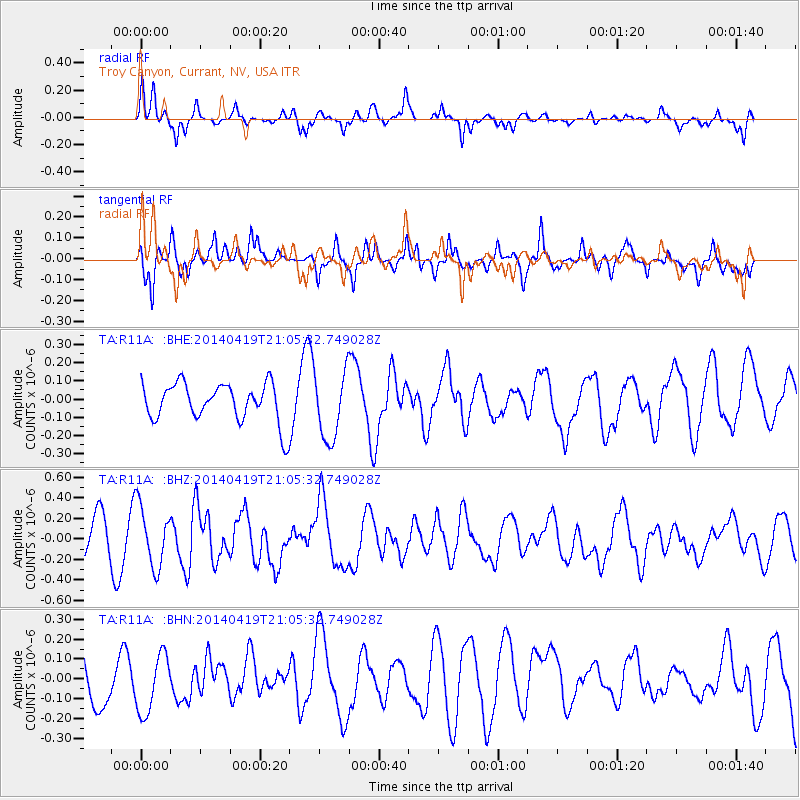
R11A Troy Canyon, Currant, NV, USA - Earthquake Result Viewer
*The percent match for this event was below the threshold and hence no stack was calculated.
| Earthquake location: |
Near Coast Of Northern Chile |
| Earthquake latitude/longitude: |
-20.0/-70.9 |
| Earthquake time(UTC): |
2014/04/19 (109) 20:54:42 GMT |
| Earthquake Depth: |
9.0 km |
| Earthquake Magnitude: |
5.8 MWR |
| Earthquake Catalog/Contributor: |
NEIC PDE/NEIC COMCAT |
|
| Network: |
TA USArray Transportable Network (new EarthScope stations) |
| Station: |
R11A Troy Canyon, Currant, NV, USA |
| Lat/Lon: |
38.35 N/115.59 W |
| Elevation: |
1756 m |
|
| Distance: |
71.6 deg |
| Az: |
324.371 deg |
| Baz: |
135.841 deg |
| Ray Param: |
$rayparam |
*The percent match for this event was below the threshold and hence was not used in the summary stack. |
|
| Radial Match: |
64.736885 % |
| Radial Bump: |
336 |
| Transverse Match: |
66.06181 % |
| Transverse Bump: |
370 |
| SOD ConfigId: |
626651 |
| Insert Time: |
2014-05-03 21:37:48.637 +0000 |
| GWidth: |
2.5 |
| Max Bumps: |
400 |
| Tol: |
0.001 |
|
Signal To Noise
| Channel | StoN | STA | LTA |
| TA:R11A: :BHZ:20140419T21:05:32.749028Z | 2.0841062 | 2.927582E-7 | 1.4047181E-7 |
| TA:R11A: :BHN:20140419T21:05:32.749028Z | 1.1672438 | 1.5217661E-7 | 1.303726E-7 |
| TA:R11A: :BHE:20140419T21:05:32.749028Z | 1.7794023 | 1.8505436E-7 | 1.0399805E-7 |
| Arrivals |
| Ps | |
| PpPs | |
| PsPs/PpSs | |


