N23A Red Feather Lakes, CO, USA - Earthquake Result Viewer
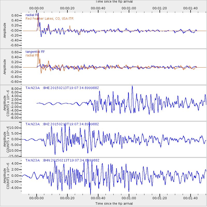
Earthquake location: Northern Mid-Atlantic Ridge
Earthquake latitude/longitude: 52.6/-31.9
Earthquake time(UTC): 2015/02/13 (044) 18:59:12 GMT
Earthquake Depth: 16 km
Earthquake Magnitude: 7.1 MWW, 6.8 MI, 7.0 MWB, 7.0 MWC, 7.1 MWC
Earthquake Catalog/Contributor: NEIC PDE/NEIC COMCAT
Network: TA USArray Transportable Network (new EarthScope stations)
Station: N23A Red Feather Lakes, CO, USA
Lat/Lon: 40.89 N/105.94 W
Elevation: 2458 m
Distance: 49.9 deg
Az: 287.684 deg
Baz: 49.992 deg
Ray Param: 0.06838128
Estimated Moho Depth: 10.25 km
Estimated Crust Vp/Vs: 1.60
Assumed Crust Vp: 6.306 km/s
Estimated Crust Vs: 3.941 km/s
Estimated Crust Poisson's Ratio: 0.18
Radial Match: 95.53407 %
Radial Bump: 400
Transverse Match: 81.64653 %
Transverse Bump: 400
SOD ConfigId: 7019011
Insert Time: 2019-04-16 19:30:09.619 +0000
GWidth: 2.5
Max Bumps: 400
Tol: 0.001

Signal To Noise

ChannelStoNSTALTA
TA:N23A: :BHZ:20150213T19:07:34.899988Z2.08747896.5468026E-73.1362245E-7
TA:N23A: :BHN:20150213T19:07:34.899988Z1.61452484.8565295E-73.008024E-7
TA:N23A: :BHE:20150213T19:07:34.899988Z1.74426035.6360227E-73.2311823E-7
Arrivals
Ps1.0 SECOND
PpPs4.0 SECOND
PsPs/PpSs5.0 SECOND