P59A Jarrettsville, MD, USA - Earthquake Result Viewer
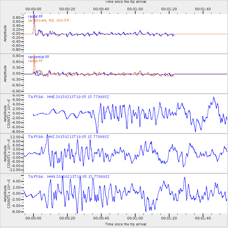
Earthquake location: Northern Mid-Atlantic Ridge
Earthquake latitude/longitude: 52.6/-31.9
Earthquake time(UTC): 2015/02/13 (044) 18:59:12 GMT
Earthquake Depth: 16 km
Earthquake Magnitude: 7.1 MWW, 6.8 MI, 7.0 MWB, 7.0 MWC, 7.1 MWC
Earthquake Catalog/Contributor: NEIC PDE/NEIC COMCAT
Network: TA USArray Transportable Network (new EarthScope stations)
Station: P59A Jarrettsville, MD, USA
Lat/Lon: 39.61 N/76.43 W
Elevation: 157 m
Distance: 33.0 deg
Az: 264.787 deg
Baz: 51.784 deg
Ray Param: 0.078410946
Estimated Moho Depth: 30.75 km
Estimated Crust Vp/Vs: 1.66
Assumed Crust Vp: 6.419 km/s
Estimated Crust Vs: 3.861 km/s
Estimated Crust Poisson's Ratio: 0.22
Radial Match: 88.95525 %
Radial Bump: 302
Transverse Match: 65.33474 %
Transverse Bump: 400
SOD ConfigId: 7019011
Insert Time: 2019-04-16 19:30:17.634 +0000
GWidth: 2.5
Max Bumps: 400
Tol: 0.001

Signal To Noise

ChannelStoNSTALTA
TA:P59A: :HHZ:20150213T19:05:15.779993Z1.67756951.398566E-68.336859E-7
TA:P59A: :HHN:20150213T19:05:15.779993Z1.12755111.1235691E-69.964685E-7
TA:P59A: :HHE:20150213T19:05:15.779993Z0.732086846.6542754E-79.0894616E-7
Arrivals
Ps3.5 SECOND
PpPs12 SECOND
PsPs/PpSs15 SECOND