You are here: Home > Network List > TA - USArray Transportable Network (new EarthScope stations) Stations List
> Station W59A Clinton, NC, USA > Earthquake Result Viewer
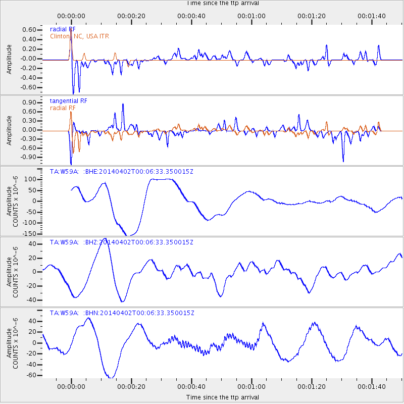
W59A Clinton, NC, USA - Earthquake Result Viewer
*The percent match for this event was below the threshold and hence no stack was calculated.
| Earthquake location: |
Near Coast Of Northern Chile |
| Earthquake latitude/longitude: |
-20.0/-70.6 |
| Earthquake time(UTC): |
2014/04/01 (091) 23:57:33 GMT |
| Earthquake Depth: |
35 km |
| Earthquake Magnitude: |
6.9 MWW, 4.9 MB |
| Earthquake Catalog/Contributor: |
NEIC PDE/NEIC COMCAT |
|
| Network: |
TA USArray Transportable Network (new EarthScope stations) |
| Station: |
W59A Clinton, NC, USA |
| Lat/Lon: |
35.17 N/78.44 W |
| Elevation: |
60 m |
|
| Distance: |
55.4 deg |
| Az: |
352.154 deg |
| Baz: |
170.987 deg |
| Ray Param: |
$rayparam |
*The percent match for this event was below the threshold and hence was not used in the summary stack. |
|
| Radial Match: |
67.40225 % |
| Radial Bump: |
400 |
| Transverse Match: |
67.33838 % |
| Transverse Bump: |
297 |
| SOD ConfigId: |
626651 |
| Insert Time: |
2014-05-03 23:17:51.207 +0000 |
| GWidth: |
2.5 |
| Max Bumps: |
400 |
| Tol: |
0.001 |
|
Signal To Noise
| Channel | StoN | STA | LTA |
| TA:W59A: :BHZ:20140402T00:06:33.350015Z | 1.4613483 | 2.97456E-5 | 2.03549E-5 |
| TA:W59A: :BHN:20140402T00:06:33.350015Z | 1.00679 | 2.7737067E-5 | 2.755E-5 |
| TA:W59A: :BHE:20140402T00:06:33.350015Z | 1.5348396 | 1.2864737E-4 | 8.381812E-5 |
| Arrivals |
| Ps | |
| PpPs | |
| PsPs/PpSs | |


