You are here: Home > Network List > TA - USArray Transportable Network (new EarthScope stations) Stations List
> Station Y57A Sumter, SC, USA > Earthquake Result Viewer
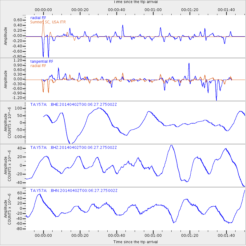
Y57A Sumter, SC, USA - Earthquake Result Viewer
*The percent match for this event was below the threshold and hence no stack was calculated.
| Earthquake location: |
Near Coast Of Northern Chile |
| Earthquake latitude/longitude: |
-20.0/-70.6 |
| Earthquake time(UTC): |
2014/04/01 (091) 23:57:33 GMT |
| Earthquake Depth: |
35 km |
| Earthquake Magnitude: |
6.9 MWW, 4.9 MB |
| Earthquake Catalog/Contributor: |
NEIC PDE/NEIC COMCAT |
|
| Network: |
TA USArray Transportable Network (new EarthScope stations) |
| Station: |
Y57A Sumter, SC, USA |
| Lat/Lon: |
34.02 N/80.39 W |
| Elevation: |
56 m |
|
| Distance: |
54.6 deg |
| Az: |
349.975 deg |
| Baz: |
168.635 deg |
| Ray Param: |
$rayparam |
*The percent match for this event was below the threshold and hence was not used in the summary stack. |
|
| Radial Match: |
63.42223 % |
| Radial Bump: |
284 |
| Transverse Match: |
47.513634 % |
| Transverse Bump: |
200 |
| SOD ConfigId: |
626651 |
| Insert Time: |
2014-05-03 23:18:32.973 +0000 |
| GWidth: |
2.5 |
| Max Bumps: |
400 |
| Tol: |
0.001 |
|
Signal To Noise
| Channel | StoN | STA | LTA |
| TA:Y57A: :BHZ:20140402T00:06:27.275002Z | 1.0275359 | 1.8747096E-5 | 1.8244711E-5 |
| TA:Y57A: :BHN:20140402T00:06:27.275002Z | 1.1360614 | 2.376818E-5 | 2.0921561E-5 |
| TA:Y57A: :BHE:20140402T00:06:27.275002Z | 1.5857563 | 1.1403694E-4 | 7.191329E-5 |
| Arrivals |
| Ps | |
| PpPs | |
| PsPs/PpSs | |


