T58A Grand View Acres, VA, USA - Earthquake Result Viewer
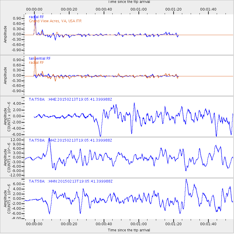
Earthquake location: Northern Mid-Atlantic Ridge
Earthquake latitude/longitude: 52.6/-31.9
Earthquake time(UTC): 2015/02/13 (044) 18:59:12 GMT
Earthquake Depth: 16 km
Earthquake Magnitude: 7.1 MWW, 6.8 MI, 7.0 MWB, 7.0 MWC, 7.1 MWC
Earthquake Catalog/Contributor: NEIC PDE/NEIC COMCAT
Network: TA USArray Transportable Network (new EarthScope stations)
Station: T58A Grand View Acres, VA, USA
Lat/Lon: 36.95 N/78.53 W
Elevation: 167 m
Distance: 35.9 deg
Az: 263.026 deg
Baz: 49.035 deg
Ray Param: 0.07693718
Estimated Moho Depth: 22.5 km
Estimated Crust Vp/Vs: 2.10
Assumed Crust Vp: 6.419 km/s
Estimated Crust Vs: 3.06 km/s
Estimated Crust Poisson's Ratio: 0.35
Radial Match: 91.16222 %
Radial Bump: 313
Transverse Match: 63.95641 %
Transverse Bump: 400
SOD ConfigId: 7019011
Insert Time: 2019-04-16 19:30:30.863 +0000
GWidth: 2.5
Max Bumps: 400
Tol: 0.001

Signal To Noise

ChannelStoNSTALTA
TA:T58A: :HHZ:20150213T19:05:41.399988Z1.55337617.7251644E-74.973145E-7
TA:T58A: :HHN:20150213T19:05:41.399988Z1.03314333.2775247E-73.1723815E-7
TA:T58A: :HHE:20150213T19:05:41.399988Z1.31289224.2026554E-73.2010664E-7
Arrivals
Ps4.1 SECOND
PpPs10 SECOND
PsPs/PpSs14 SECOND