You are here: Home > Network List > UW - Pacific Northwest Regional Seismic Network Stations List
> Station LON Longmire CREST broad-band > Earthquake Result Viewer
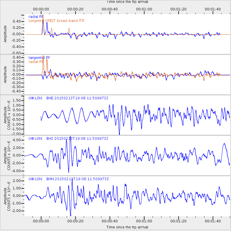
LON Longmire CREST broad-band - Earthquake Result Viewer
*The percent match for this event was below the threshold and hence no stack was calculated.
| Earthquake location: |
Northern Mid-Atlantic Ridge |
| Earthquake latitude/longitude: |
52.6/-31.9 |
| Earthquake time(UTC): |
2015/02/13 (044) 18:59:12 GMT |
| Earthquake Depth: |
16 km |
| Earthquake Magnitude: |
7.1 MWW, 6.8 MI, 7.0 MWB, 7.0 MWC, 7.1 MWC |
| Earthquake Catalog/Contributor: |
NEIC PDE/NEIC COMCAT |
|
| Network: |
UW Pacific Northwest Regional Seismic Network |
| Station: |
LON Longmire CREST broad-band |
| Lat/Lon: |
46.75 N/121.81 W |
| Elevation: |
853 m |
|
| Distance: |
54.8 deg |
| Az: |
302.722 deg |
| Baz: |
48.218 deg |
| Ray Param: |
$rayparam |
*The percent match for this event was below the threshold and hence was not used in the summary stack. |
|
| Radial Match: |
77.08077 % |
| Radial Bump: |
395 |
| Transverse Match: |
56.760853 % |
| Transverse Bump: |
400 |
| SOD ConfigId: |
7019011 |
| Insert Time: |
2019-04-16 19:31:57.119 +0000 |
| GWidth: |
2.5 |
| Max Bumps: |
400 |
| Tol: |
0.001 |
|
Signal To Noise
| Channel | StoN | STA | LTA |
| UW:LON: :BHZ:20150213T19:08:11.509973Z | 4.44862 | 1.2649025E-6 | 2.8433593E-7 |
| UW:LON: :BHN:20150213T19:08:11.509973Z | 1.9855103 | 5.127304E-7 | 2.582361E-7 |
| UW:LON: :BHE:20150213T19:08:11.509973Z | 0.72646594 | 2.9802936E-7 | 4.1024546E-7 |
| Arrivals |
| Ps | |
| PpPs | |
| PsPs/PpSs | |


