SAM Savane Anatole - Martinique - Earthquake Result Viewer
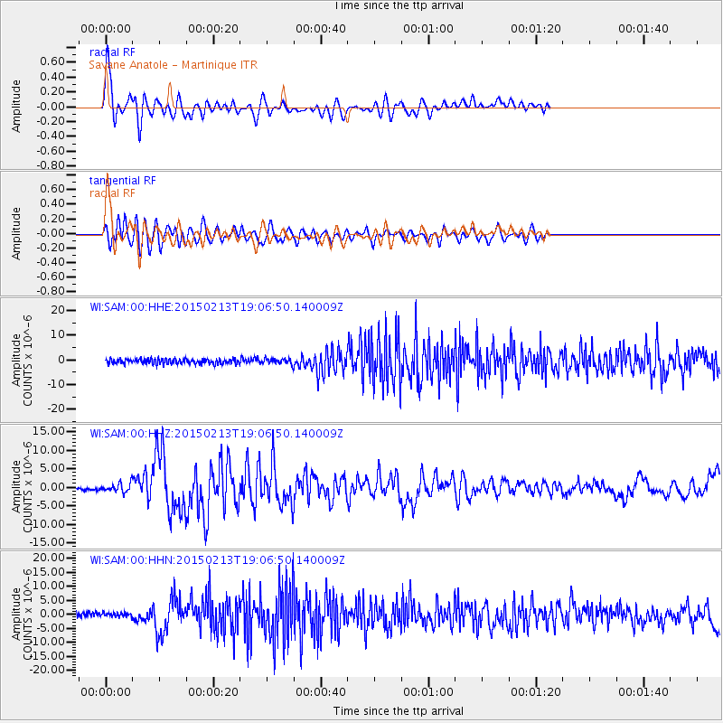
Earthquake location: Northern Mid-Atlantic Ridge
Earthquake latitude/longitude: 52.6/-31.9
Earthquake time(UTC): 2015/02/13 (044) 18:59:12 GMT
Earthquake Depth: 16 km
Earthquake Magnitude: 7.1 MWW, 6.8 MI, 7.0 MWB, 7.0 MWC, 7.1 MWC
Earthquake Catalog/Contributor: NEIC PDE/NEIC COMCAT
Network: WI West Indies IPGP Network
Station: SAM Savane Anatole - Martinique
Lat/Lon: 14.84 N/61.17 W
Elevation: 510 m
Distance: 44.3 deg
Az: 222.646 deg
Baz: 25.274 deg
Ray Param: 0.07199417
Estimated Moho Depth: 29.5 km
Estimated Crust Vp/Vs: 1.85
Assumed Crust Vp: 5.88 km/s
Estimated Crust Vs: 3.183 km/s
Estimated Crust Poisson's Ratio: 0.29
Radial Match: 90.75212 %
Radial Bump: 400
Transverse Match: 87.31941 %
Transverse Bump: 400
SOD ConfigId: 7019011
Insert Time: 2019-04-16 19:32:47.144 +0000
GWidth: 2.5
Max Bumps: 400
Tol: 0.001

Signal To Noise

ChannelStoNSTALTA
WI:SAM:00:HHZ:20150213T19:06:50.140009Z2.90768531.1311861E-63.890332E-7
WI:SAM:00:HHN:20150213T19:06:50.140009Z0.86792257.603449E-78.760516E-7
WI:SAM:00:HHE:20150213T19:06:50.140009Z1.00251019.810312E-79.78575E-7
Arrivals
Ps4.5 SECOND
PpPs14 SECOND
PsPs/PpSs18 SECOND