You are here: Home > Network List > WY - Yellowstone Wyoming Seismic Network Stations List
> Station YHH Holmes Hill, YNP, WY, USA > Earthquake Result Viewer
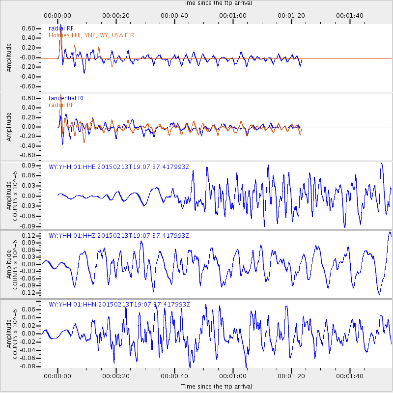
YHH Holmes Hill, YNP, WY, USA - Earthquake Result Viewer
*The percent match for this event was below the threshold and hence no stack was calculated.
| Earthquake location: |
Northern Mid-Atlantic Ridge |
| Earthquake latitude/longitude: |
52.6/-31.9 |
| Earthquake time(UTC): |
2015/02/13 (044) 18:59:12 GMT |
| Earthquake Depth: |
16 km |
| Earthquake Magnitude: |
7.1 MWW, 6.8 MI, 7.0 MWB, 7.0 MWC, 7.1 MWC |
| Earthquake Catalog/Contributor: |
NEIC PDE/NEIC COMCAT |
|
| Network: |
WY Yellowstone Wyoming Seismic Network |
| Station: |
YHH Holmes Hill, YNP, WY, USA |
| Lat/Lon: |
44.79 N/110.85 W |
| Elevation: |
2717 m |
|
| Distance: |
50.2 deg |
| Az: |
294.591 deg |
| Baz: |
51.102 deg |
| Ray Param: |
$rayparam |
*The percent match for this event was below the threshold and hence was not used in the summary stack. |
|
| Radial Match: |
72.53605 % |
| Radial Bump: |
400 |
| Transverse Match: |
61.596256 % |
| Transverse Bump: |
400 |
| SOD ConfigId: |
7019011 |
| Insert Time: |
2019-04-16 19:32:55.599 +0000 |
| GWidth: |
2.5 |
| Max Bumps: |
400 |
| Tol: |
0.001 |
|
Signal To Noise
| Channel | StoN | STA | LTA |
| WY:YHH:01:HHZ:20150213T19:07:37.417993Z | 0.93589914 | 1.2782404E-8 | 1.36578855E-8 |
| WY:YHH:01:HHN:20150213T19:07:37.417993Z | 0.89624894 | 8.184809E-9 | 9.132295E-9 |
| WY:YHH:01:HHE:20150213T19:07:37.417993Z | 3.143932 | 1.8504789E-8 | 5.885874E-9 |
| Arrivals |
| Ps | |
| PpPs | |
| PsPs/PpSs | |


