You are here: Home > Network List > TA - USArray Transportable Network (new EarthScope stations) Stations List
> Station L04D Klamath Falls, OR, USA > Earthquake Result Viewer
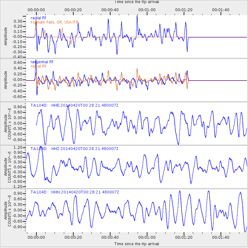
L04D Klamath Falls, OR, USA - Earthquake Result Viewer
*The percent match for this event was below the threshold and hence no stack was calculated.
| Earthquake location: |
Solomon Islands |
| Earthquake latitude/longitude: |
-7.2/155.3 |
| Earthquake time(UTC): |
2014/04/20 (110) 00:15:58 GMT |
| Earthquake Depth: |
18 km |
| Earthquake Magnitude: |
6.1 MWP |
| Earthquake Catalog/Contributor: |
NEIC PDE/NEIC COMCAT |
|
| Network: |
TA USArray Transportable Network (new EarthScope stations) |
| Station: |
L04D Klamath Falls, OR, USA |
| Lat/Lon: |
42.22 N/122.30 W |
| Elevation: |
1437 m |
|
| Distance: |
89.2 deg |
| Az: |
47.422 deg |
| Baz: |
259.622 deg |
| Ray Param: |
$rayparam |
*The percent match for this event was below the threshold and hence was not used in the summary stack. |
|
| Radial Match: |
55.44403 % |
| Radial Bump: |
400 |
| Transverse Match: |
41.920406 % |
| Transverse Bump: |
400 |
| SOD ConfigId: |
626651 |
| Insert Time: |
2014-05-04 00:42:06.758 +0000 |
| GWidth: |
2.5 |
| Max Bumps: |
400 |
| Tol: |
0.001 |
|
Signal To Noise
| Channel | StoN | STA | LTA |
| TA:L04D: :HHZ:20140420T00:28:21.480007Z | 1.7275296 | 7.823294E-7 | 4.528602E-7 |
| TA:L04D: :HHN:20140420T00:28:21.480007Z | 0.5230704 | 3.0151534E-7 | 5.7643365E-7 |
| TA:L04D: :HHE:20140420T00:28:21.480007Z | 0.8010542 | 4.4069006E-7 | 5.501376E-7 |
| Arrivals |
| Ps | |
| PpPs | |
| PsPs/PpSs | |


