You are here: Home > Network List > AK - Alaska Regional Network Stations List
> Station MDM Murphy Dome > Earthquake Result Viewer
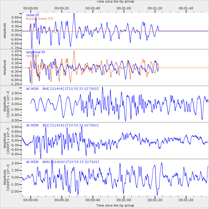
MDM Murphy Dome - Earthquake Result Viewer
*The percent match for this event was below the threshold and hence no stack was calculated.
| Earthquake location: |
Philippine Islands Region |
| Earthquake latitude/longitude: |
17.4/119.9 |
| Earthquake time(UTC): |
2014/04/21 (111) 20:45:22 GMT |
| Earthquake Depth: |
11 km |
| Earthquake Magnitude: |
5.5 MWB |
| Earthquake Catalog/Contributor: |
NEIC PDE/NEIC COMCAT |
|
| Network: |
AK Alaska Regional Network |
| Station: |
MDM Murphy Dome |
| Lat/Lon: |
64.96 N/148.23 W |
| Elevation: |
634 m |
|
| Distance: |
75.2 deg |
| Az: |
26.108 deg |
| Baz: |
279.238 deg |
| Ray Param: |
$rayparam |
*The percent match for this event was below the threshold and hence was not used in the summary stack. |
|
| Radial Match: |
55.998672 % |
| Radial Bump: |
400 |
| Transverse Match: |
59.077557 % |
| Transverse Bump: |
400 |
| SOD ConfigId: |
626651 |
| Insert Time: |
2014-05-05 21:25:39.674 +0000 |
| GWidth: |
2.5 |
| Max Bumps: |
400 |
| Tol: |
0.001 |
|
Signal To Noise
| Channel | StoN | STA | LTA |
| AK:MDM: :BHZ:20140421T20:56:33.027993Z | 1.3864516 | 5.7956186E-7 | 4.180181E-7 |
| AK:MDM: :BHN:20140421T20:56:33.027993Z | 0.69165593 | 6.7754723E-7 | 9.796016E-7 |
| AK:MDM: :BHE:20140421T20:56:33.027993Z | 0.8815365 | 8.630639E-7 | 9.79045E-7 |
| Arrivals |
| Ps | |
| PpPs | |
| PsPs/PpSs | |


