You are here: Home > Network List > II - Global Seismograph Network (GSN - IRIS/IDA) Stations List
> Station WRAB Tennant Creek, NT, Australia > Earthquake Result Viewer
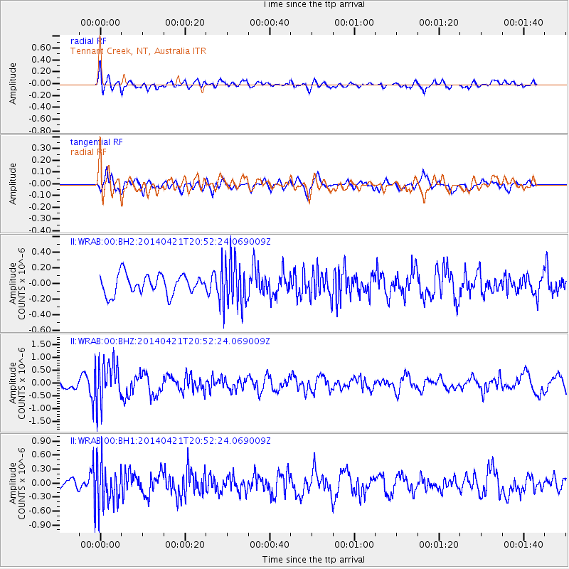
WRAB Tennant Creek, NT, Australia - Earthquake Result Viewer
*The percent match for this event was below the threshold and hence no stack was calculated.
| Earthquake location: |
Philippine Islands Region |
| Earthquake latitude/longitude: |
17.4/119.9 |
| Earthquake time(UTC): |
2014/04/21 (111) 20:45:22 GMT |
| Earthquake Depth: |
11 km |
| Earthquake Magnitude: |
5.5 MWB |
| Earthquake Catalog/Contributor: |
NEIC PDE/NEIC COMCAT |
|
| Network: |
II Global Seismograph Network (GSN - IRIS/IDA) |
| Station: |
WRAB Tennant Creek, NT, Australia |
| Lat/Lon: |
19.93 S/134.36 E |
| Elevation: |
366 m |
|
| Distance: |
39.8 deg |
| Az: |
158.434 deg |
| Baz: |
338.101 deg |
| Ray Param: |
$rayparam |
*The percent match for this event was below the threshold and hence was not used in the summary stack. |
|
| Radial Match: |
53.043163 % |
| Radial Bump: |
400 |
| Transverse Match: |
61.6127 % |
| Transverse Bump: |
400 |
| SOD ConfigId: |
626651 |
| Insert Time: |
2014-05-05 21:33:01.347 +0000 |
| GWidth: |
2.5 |
| Max Bumps: |
400 |
| Tol: |
0.001 |
|
Signal To Noise
| Channel | StoN | STA | LTA |
| II:WRAB:00:BHZ:20140421T20:52:24.069009Z | 5.1342325 | 8.022682E-7 | 1.5625865E-7 |
| II:WRAB:00:BH1:20140421T20:52:24.069009Z | 3.8184876 | 4.336735E-7 | 1.1357206E-7 |
| II:WRAB:00:BH2:20140421T20:52:24.069009Z | 2.3724344 | 2.9095668E-7 | 1.2264056E-7 |
| Arrivals |
| Ps | |
| PpPs | |
| PsPs/PpSs | |


