You are here: Home > Network List > IU - Global Seismograph Network (GSN - IRIS/USGS) Stations List
> Station PMG Port Moresby, New Guinea > Earthquake Result Viewer
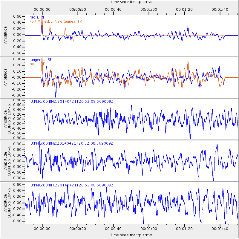
PMG Port Moresby, New Guinea - Earthquake Result Viewer
*The percent match for this event was below the threshold and hence no stack was calculated.
| Earthquake location: |
Philippine Islands Region |
| Earthquake latitude/longitude: |
17.4/119.9 |
| Earthquake time(UTC): |
2014/04/21 (111) 20:45:22 GMT |
| Earthquake Depth: |
11 km |
| Earthquake Magnitude: |
5.5 MWB |
| Earthquake Catalog/Contributor: |
NEIC PDE/NEIC COMCAT |
|
| Network: |
IU Global Seismograph Network (GSN - IRIS/USGS) |
| Station: |
PMG Port Moresby, New Guinea |
| Lat/Lon: |
9.40 S/147.16 E |
| Elevation: |
90 m |
|
| Distance: |
37.9 deg |
| Az: |
132.632 deg |
| Baz: |
314.621 deg |
| Ray Param: |
$rayparam |
*The percent match for this event was below the threshold and hence was not used in the summary stack. |
|
| Radial Match: |
61.257275 % |
| Radial Bump: |
400 |
| Transverse Match: |
52.601482 % |
| Transverse Bump: |
400 |
| SOD ConfigId: |
626651 |
| Insert Time: |
2014-05-05 21:34:02.610 +0000 |
| GWidth: |
2.5 |
| Max Bumps: |
400 |
| Tol: |
0.001 |
|
Signal To Noise
| Channel | StoN | STA | LTA |
| IU:PMG:00:BHZ:20140421T20:52:08.569009Z | 2.465118 | 4.0270896E-7 | 1.6336296E-7 |
| IU:PMG:00:BH1:20140421T20:52:08.569009Z | 0.9532966 | 1.5114723E-7 | 1.5855214E-7 |
| IU:PMG:00:BH2:20140421T20:52:08.569009Z | 1.4788306 | 2.6522528E-7 | 1.7934798E-7 |
| Arrivals |
| Ps | |
| PpPs | |
| PsPs/PpSs | |


