You are here: Home > Network List > TJ - Tajikistan National Seismic Network Stations List
> Station GARM Garm, Tajikistan > Earthquake Result Viewer
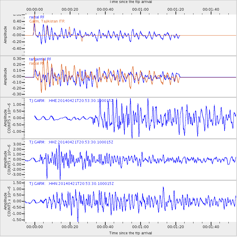
GARM Garm, Tajikistan - Earthquake Result Viewer
*The percent match for this event was below the threshold and hence no stack was calculated.
| Earthquake location: |
Philippine Islands Region |
| Earthquake latitude/longitude: |
17.4/119.9 |
| Earthquake time(UTC): |
2014/04/21 (111) 20:45:22 GMT |
| Earthquake Depth: |
11 km |
| Earthquake Magnitude: |
5.5 MWB |
| Earthquake Catalog/Contributor: |
NEIC PDE/NEIC COMCAT |
|
| Network: |
TJ Tajikistan National Seismic Network |
| Station: |
GARM Garm, Tajikistan |
| Lat/Lon: |
39.00 N/70.32 E |
| Elevation: |
1305 m |
|
| Distance: |
48.0 deg |
| Az: |
307.051 deg |
| Baz: |
102.109 deg |
| Ray Param: |
$rayparam |
*The percent match for this event was below the threshold and hence was not used in the summary stack. |
|
| Radial Match: |
70.10506 % |
| Radial Bump: |
329 |
| Transverse Match: |
66.78302 % |
| Transverse Bump: |
400 |
| SOD ConfigId: |
626651 |
| Insert Time: |
2014-05-05 21:38:44.940 +0000 |
| GWidth: |
2.5 |
| Max Bumps: |
400 |
| Tol: |
0.001 |
|
Signal To Noise
| Channel | StoN | STA | LTA |
| TJ:GARM: :HHZ:20140421T20:53:30.100015Z | 3.7832253 | 3.9764768E-7 | 1.05108114E-7 |
| TJ:GARM: :HHN:20140421T20:53:30.100015Z | 1.1008676 | 8.82896E-8 | 8.020002E-8 |
| TJ:GARM: :HHE:20140421T20:53:30.100015Z | 1.6643093 | 1.4040822E-7 | 8.436426E-8 |
| Arrivals |
| Ps | |
| PpPs | |
| PsPs/PpSs | |


