You are here: Home > Network List > UW - Pacific Northwest Regional Seismic Network Stations List
> Station PASS Maple Falls, WA, USA > Earthquake Result Viewer
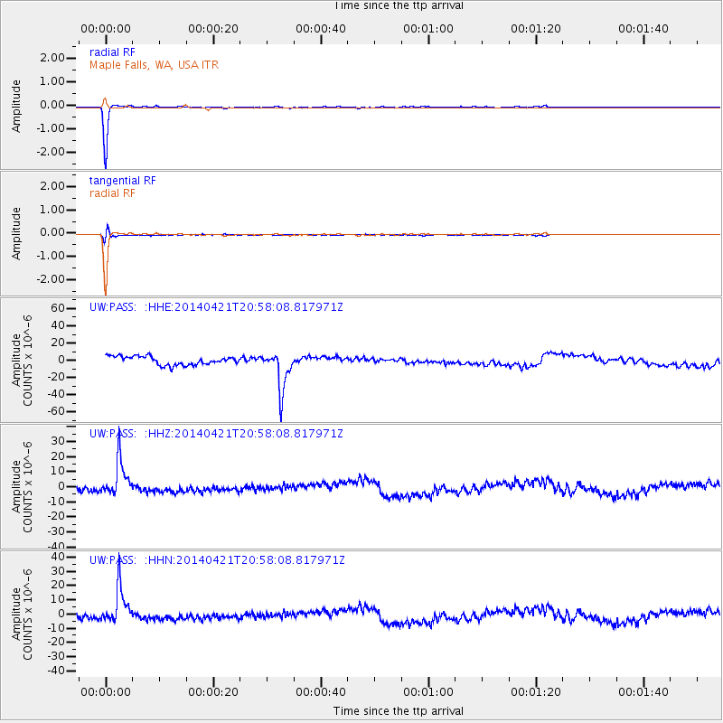
PASS Maple Falls, WA, USA - Earthquake Result Viewer
*The percent match for this event was below the threshold and hence no stack was calculated.
| Earthquake location: |
Philippine Islands Region |
| Earthquake latitude/longitude: |
17.4/119.9 |
| Earthquake time(UTC): |
2014/04/21 (111) 20:45:22 GMT |
| Earthquake Depth: |
11 km |
| Earthquake Magnitude: |
5.5 MWB |
| Earthquake Catalog/Contributor: |
NEIC PDE/NEIC COMCAT |
|
| Network: |
UW Pacific Northwest Regional Seismic Network |
| Station: |
PASS Maple Falls, WA, USA |
| Lat/Lon: |
49.00 N/122.09 W |
| Elevation: |
174 m |
|
| Distance: |
94.1 deg |
| Az: |
35.65 deg |
| Baz: |
302.35 deg |
| Ray Param: |
$rayparam |
*The percent match for this event was below the threshold and hence was not used in the summary stack. |
|
| Radial Match: |
98.18857 % |
| Radial Bump: |
93 |
| Transverse Match: |
70.67809 % |
| Transverse Bump: |
400 |
| SOD ConfigId: |
626651 |
| Insert Time: |
2014-05-05 21:39:33.449 +0000 |
| GWidth: |
2.5 |
| Max Bumps: |
400 |
| Tol: |
0.001 |
|
Signal To Noise
| Channel | StoN | STA | LTA |
| UW:PASS: :HHZ:20140421T20:58:08.817971Z | 3.2225175 | 1.2471846E-5 | 3.8702187E-6 |
| UW:PASS: :HHN:20140421T20:58:08.817971Z | 3.0792117 | 1.3235906E-5 | 4.2984725E-6 |
| UW:PASS: :HHE:20140421T20:58:08.817971Z | 4.5254307 | 2.2393324E-5 | 4.9483297E-6 |
| Arrivals |
| Ps | |
| PpPs | |
| PsPs/PpSs | |


