KAPI Kappang, Sulawesi, Indonesia - Earthquake Result Viewer
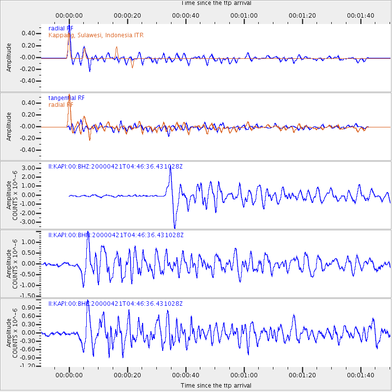
Earthquake location: Andreanof Islands, Aleutian Is.
Earthquake latitude/longitude: 51.4/-178.1
Earthquake time(UTC): 2000/04/21 (112) 04:35:17 GMT
Earthquake Depth: 33 km
Earthquake Magnitude: 6.0 MB, 5.7 MS, 6.2 ML, 6.0 MW
Earthquake Catalog/Contributor: WHDF/NEIC
Network: II Global Seismograph Network (GSN - IRIS/IDA)
Station: KAPI Kappang, Sulawesi, Indonesia
Lat/Lon: 5.01 S/119.75 E
Elevation: 300 m
Distance: 77.1 deg
Az: 244.621 deg
Baz: 34.601 deg
Ray Param: 0.050537042
Estimated Moho Depth: 30.75 km
Estimated Crust Vp/Vs: 2.08
Assumed Crust Vp: 6.343 km/s
Estimated Crust Vs: 3.053 km/s
Estimated Crust Poisson's Ratio: 0.35
Radial Match: 94.87294 %
Radial Bump: 400
Transverse Match: 87.406364 %
Transverse Bump: 400
SOD ConfigId: 3744
Insert Time: 2010-03-01 21:25:57.097 +0000
GWidth: 2.5
Max Bumps: 400
Tol: 0.001

Signal To Noise

ChannelStoNSTALTA
II:KAPI:00:BHN:20000421T04:46:36.431028Z5.7820322.8876448E-74.9941697E-8
II:KAPI:00:BHE:20000421T04:46:36.431028Z3.87181742.0113069E-75.194736E-8
II:KAPI:00:BHZ:20000421T04:46:36.431028Z14.2151179.64501E-76.785037E-8
Arrivals
Ps5.4 SECOND
PpPs15 SECOND
PsPs/PpSs20 SECOND