You are here: Home > Network List > AV - Alaska Volcano Observatory Stations List
> Station MAPS Pakushin Southeast, Makushin Volcano, Alaska > Earthquake Result Viewer
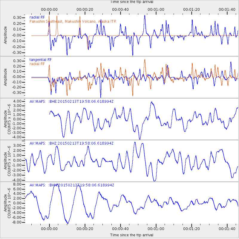
MAPS Pakushin Southeast, Makushin Volcano, Alaska - Earthquake Result Viewer
*The percent match for this event was below the threshold and hence no stack was calculated.
| Earthquake location: |
Northern Mid-Atlantic Ridge |
| Earthquake latitude/longitude: |
52.7/-31.9 |
| Earthquake time(UTC): |
2015/02/13 (044) 19:47:42 GMT |
| Earthquake Depth: |
13 km |
| Earthquake Magnitude: |
4.8 mb |
| Earthquake Catalog/Contributor: |
ISC/ISC |
|
| Network: |
AV Alaska Volcano Observatory |
| Station: |
MAPS Pakushin Southeast, Makushin Volcano, Alaska |
| Lat/Lon: |
53.81 N/166.94 W |
| Elevation: |
333 m |
|
| Distance: |
67.4 deg |
| Az: |
333.003 deg |
| Baz: |
27.751 deg |
| Ray Param: |
$rayparam |
*The percent match for this event was below the threshold and hence was not used in the summary stack. |
|
| Radial Match: |
43.23204 % |
| Radial Bump: |
395 |
| Transverse Match: |
44.524868 % |
| Transverse Bump: |
400 |
| SOD ConfigId: |
7019011 |
| Insert Time: |
2019-04-16 19:45:47.300 +0000 |
| GWidth: |
2.5 |
| Max Bumps: |
400 |
| Tol: |
0.001 |
|
Signal To Noise
| Channel | StoN | STA | LTA |
| AV:MAPS: :BHZ:20150213T19:58:06.618994Z | 0.9330703 | 1.6450508E-6 | 1.7630513E-6 |
| AV:MAPS: :BHN:20150213T19:58:06.618994Z | 2.0381968 | 5.7996363E-6 | 2.8454742E-6 |
| AV:MAPS: :BHE:20150213T19:58:06.618994Z | 0.89102596 | 1.4427759E-6 | 1.6192298E-6 |
| Arrivals |
| Ps | |
| PpPs | |
| PsPs/PpSs | |


