You are here: Home > Network List > TA - USArray Transportable Network (new EarthScope stations) Stations List
> Station P50A Jamestown, OH, USA > Earthquake Result Viewer
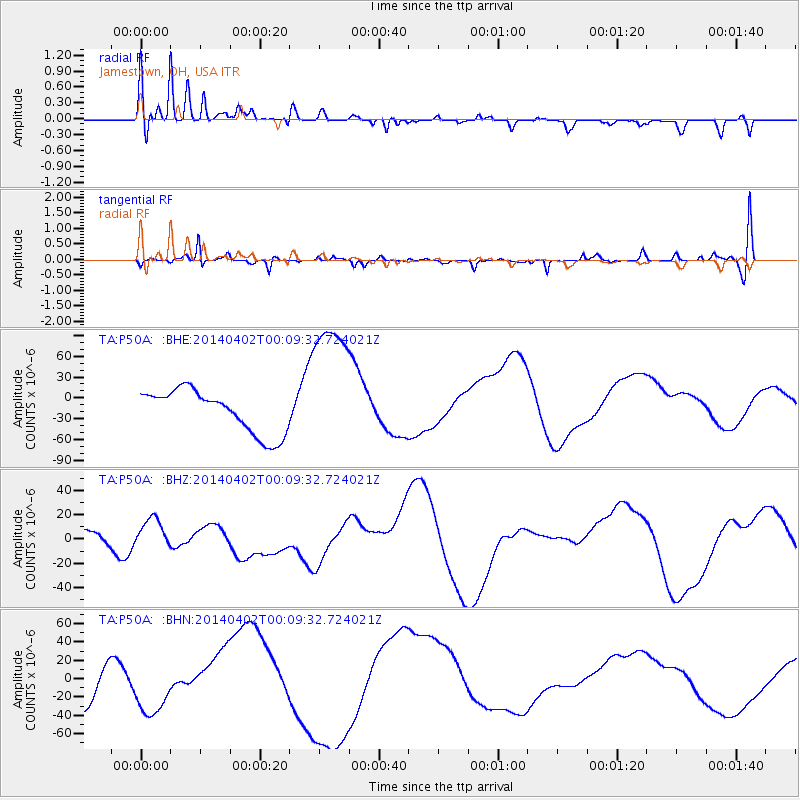
P50A Jamestown, OH, USA - Earthquake Result Viewer
*The percent match for this event was below the threshold and hence no stack was calculated.
| Earthquake location: |
Near Coast Of Northern Chile |
| Earthquake latitude/longitude: |
-19.5/-70.2 |
| Earthquake time(UTC): |
2014/04/01 (091) 23:59:57 GMT |
| Earthquake Depth: |
22 km |
| Earthquake Magnitude: |
5.8 MB |
| Earthquake Catalog/Contributor: |
NEIC PDE/NEIC COMCAT |
|
| Network: |
TA USArray Transportable Network (new EarthScope stations) |
| Station: |
P50A Jamestown, OH, USA |
| Lat/Lon: |
39.61 N/83.80 W |
| Elevation: |
318 m |
|
| Distance: |
60.2 deg |
| Az: |
347.883 deg |
| Baz: |
165.147 deg |
| Ray Param: |
$rayparam |
*The percent match for this event was below the threshold and hence was not used in the summary stack. |
|
| Radial Match: |
46.321716 % |
| Radial Bump: |
400 |
| Transverse Match: |
47.972958 % |
| Transverse Bump: |
357 |
| SOD ConfigId: |
626651 |
| Insert Time: |
2014-05-07 03:43:48.070 +0000 |
| GWidth: |
2.5 |
| Max Bumps: |
400 |
| Tol: |
0.001 |
|
Signal To Noise
| Channel | StoN | STA | LTA |
| TA:P50A: :BHZ:20140402T00:09:32.724021Z | 1.7268188 | 1.2400357E-5 | 7.181041E-6 |
| TA:P50A: :BHN:20140402T00:09:32.724021Z | 1.6816901 | 2.9688192E-5 | 1.7653783E-5 |
| TA:P50A: :BHE:20140402T00:09:32.724021Z | 3.391228 | 1.05036605E-4 | 3.0973028E-5 |
| Arrivals |
| Ps | |
| PpPs | |
| PsPs/PpSs | |


