You are here: Home > Network List > TA - USArray Transportable Network (new EarthScope stations) Stations List
> Station J04D Umpqua National Forest, Toketee, OR, USA > Earthquake Result Viewer
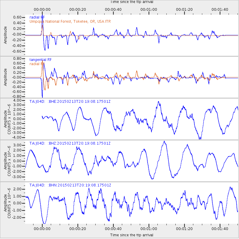
J04D Umpqua National Forest, Toketee, OR, USA - Earthquake Result Viewer
*The percent match for this event was below the threshold and hence no stack was calculated.
| Earthquake location: |
Taiwan Region |
| Earthquake latitude/longitude: |
22.6/121.4 |
| Earthquake time(UTC): |
2015/02/13 (044) 20:06:31 GMT |
| Earthquake Depth: |
24 km |
| Earthquake Magnitude: |
6.2 MWW, 6.1 MWR, 6.3 MWC |
| Earthquake Catalog/Contributor: |
NEIC PDE/NEIC COMCAT |
|
| Network: |
TA USArray Transportable Network (new EarthScope stations) |
| Station: |
J04D Umpqua National Forest, Toketee, OR, USA |
| Lat/Lon: |
43.24 N/122.11 W |
| Elevation: |
1948 m |
|
| Distance: |
92.3 deg |
| Az: |
40.898 deg |
| Baz: |
304.126 deg |
| Ray Param: |
$rayparam |
*The percent match for this event was below the threshold and hence was not used in the summary stack. |
|
| Radial Match: |
52.05753 % |
| Radial Bump: |
400 |
| Transverse Match: |
55.790802 % |
| Transverse Bump: |
400 |
| SOD ConfigId: |
7019011 |
| Insert Time: |
2019-04-16 19:56:56.237 +0000 |
| GWidth: |
2.5 |
| Max Bumps: |
400 |
| Tol: |
0.001 |
|
Signal To Noise
| Channel | StoN | STA | LTA |
| TA:J04D: :BHZ:20150213T20:19:08.17501Z | 1.6002901 | 1.4647652E-6 | 9.1531234E-7 |
| TA:J04D: :BHN:20150213T20:19:08.17501Z | 1.7470889 | 1.8791344E-6 | 1.0755804E-6 |
| TA:J04D: :BHE:20150213T20:19:08.17501Z | 2.0971417 | 2.5261263E-6 | 1.2045568E-6 |
| Arrivals |
| Ps | |
| PpPs | |
| PsPs/PpSs | |


