You are here: Home > Network List > TA - USArray Transportable Network (new EarthScope stations) Stations List
> Station M52A Chesterland, OH, USA > Earthquake Result Viewer
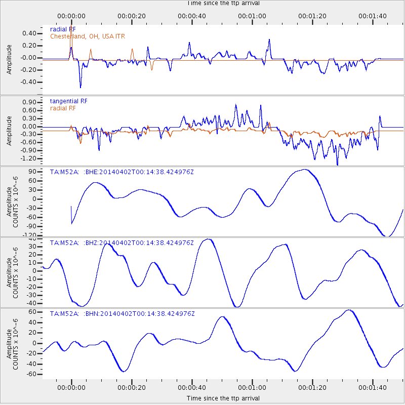
M52A Chesterland, OH, USA - Earthquake Result Viewer
*The percent match for this event was below the threshold and hence no stack was calculated.
| Earthquake location: |
Near Coast Of Northern Chile |
| Earthquake latitude/longitude: |
-19.6/-70.5 |
| Earthquake time(UTC): |
2014/04/02 (092) 00:04:54 GMT |
| Earthquake Depth: |
34 km |
| Earthquake Magnitude: |
5.5 MB |
| Earthquake Catalog/Contributor: |
NEIC PDE/NEIC COMCAT |
|
| Network: |
TA USArray Transportable Network (new EarthScope stations) |
| Station: |
M52A Chesterland, OH, USA |
| Lat/Lon: |
41.54 N/81.36 W |
| Elevation: |
382 m |
|
| Distance: |
61.7 deg |
| Az: |
350.753 deg |
| Baz: |
168.357 deg |
| Ray Param: |
$rayparam |
*The percent match for this event was below the threshold and hence was not used in the summary stack. |
|
| Radial Match: |
64.34254 % |
| Radial Bump: |
400 |
| Transverse Match: |
62.37547 % |
| Transverse Bump: |
400 |
| SOD ConfigId: |
626651 |
| Insert Time: |
2014-05-07 04:26:37.644 +0000 |
| GWidth: |
2.5 |
| Max Bumps: |
400 |
| Tol: |
0.001 |
|
Signal To Noise
| Channel | StoN | STA | LTA |
| TA:M52A: :BHZ:20140402T00:14:38.424976Z | 1.6176949 | 4.164491E-5 | 2.5743368E-5 |
| TA:M52A: :BHN:20140402T00:14:38.424976Z | 0.40541846 | 9.855388E-6 | 2.4309174E-5 |
| TA:M52A: :BHE:20140402T00:14:38.424976Z | 1.1638572 | 3.5043766E-5 | 3.0110024E-5 |
| Arrivals |
| Ps | |
| PpPs | |
| PsPs/PpSs | |


