You are here: Home > Network List > PF - Volcanologic Network of Piton de Fournaise-OVPF Stations List
> Station GPS Grandes Pentes Sud > Earthquake Result Viewer
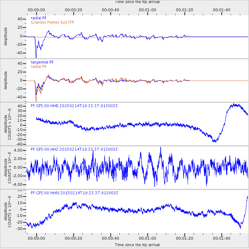
GPS Grandes Pentes Sud - Earthquake Result Viewer
*The percent match for this event was below the threshold and hence no stack was calculated.
| Earthquake location: |
South Sandwich Islands Region |
| Earthquake latitude/longitude: |
-55.4/-29.7 |
| Earthquake time(UTC): |
2015/02/14 (045) 19:12:58 GMT |
| Earthquake Depth: |
28 km |
| Earthquake Magnitude: |
4.9 MW |
| Earthquake Catalog/Contributor: |
ISC/ISC |
|
| Network: |
PF Volcanologic Network of Piton de Fournaise-OVPF |
| Station: |
GPS Grandes Pentes Sud |
| Lat/Lon: |
21.27 S/55.76 E |
| Elevation: |
1004 m |
|
| Distance: |
70.2 deg |
| Az: |
98.898 deg |
| Baz: |
217.188 deg |
| Ray Param: |
$rayparam |
*The percent match for this event was below the threshold and hence was not used in the summary stack. |
|
| Radial Match: |
73.8187 % |
| Radial Bump: |
400 |
| Transverse Match: |
79.735504 % |
| Transverse Bump: |
400 |
| SOD ConfigId: |
7019011 |
| Insert Time: |
2019-04-16 20:00:43.066 +0000 |
| GWidth: |
2.5 |
| Max Bumps: |
400 |
| Tol: |
0.001 |
|
Signal To Noise
| Channel | StoN | STA | LTA |
| PF:GPS:00:HHZ:20150214T19:23:37.913003Z | 0.87911457 | 1.0904289E-6 | 1.2403718E-6 |
| PF:GPS:00:HHN:20150214T19:23:37.913003Z | 2.8925729 | 3.4529516E-5 | 1.1937303E-5 |
| PF:GPS:00:HHE:20150214T19:23:37.913003Z | 2.610361 | 1.2469517E-5 | 4.7769317E-6 |
| Arrivals |
| Ps | |
| PpPs | |
| PsPs/PpSs | |


