You are here: Home > Network List > GS - US Geological Survey Networks Stations List
> Station DEC09 Decatur Surface Seismic Site, Decatur, IL, USA > Earthquake Result Viewer
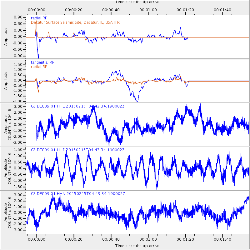
DEC09 Decatur Surface Seismic Site, Decatur, IL, USA - Earthquake Result Viewer
*The percent match for this event was below the threshold and hence no stack was calculated.
| Earthquake location: |
Reykjanes Ridge |
| Earthquake latitude/longitude: |
52.7/-33.5 |
| Earthquake time(UTC): |
2015/02/15 (046) 04:36:35 GMT |
| Earthquake Depth: |
10 km |
| Earthquake Magnitude: |
5.0 MW |
| Earthquake Catalog/Contributor: |
ISC/ISC |
|
| Network: |
GS US Geological Survey Networks |
| Station: |
DEC09 Decatur Surface Seismic Site, Decatur, IL, USA |
| Lat/Lon: |
39.87 N/88.92 W |
| Elevation: |
207 m |
|
| Distance: |
39.4 deg |
| Az: |
273.767 deg |
| Baz: |
52.101 deg |
| Ray Param: |
$rayparam |
*The percent match for this event was below the threshold and hence was not used in the summary stack. |
|
| Radial Match: |
44.14234 % |
| Radial Bump: |
400 |
| Transverse Match: |
16.244493 % |
| Transverse Bump: |
400 |
| SOD ConfigId: |
7019011 |
| Insert Time: |
2019-04-16 20:05:20.768 +0000 |
| GWidth: |
2.5 |
| Max Bumps: |
400 |
| Tol: |
0.001 |
|
Signal To Noise
| Channel | StoN | STA | LTA |
| GS:DEC09:01:HHZ:20150215T04:43:34.190002Z | 1.0469513 | 3.9870707E-7 | 3.8082675E-7 |
| GS:DEC09:01:HHN:20150215T04:43:34.190002Z | 1.1038723 | 1.3757502E-6 | 1.2462948E-6 |
| GS:DEC09:01:HHE:20150215T04:43:34.190002Z | 1.7053685 | 1.7911591E-6 | 1.0503062E-6 |
| Arrivals |
| Ps | |
| PpPs | |
| PsPs/PpSs | |


