You are here: Home > Network List > NM - Cooperative New Madrid Seismic Network Stations List
> Station HDAR2 I40 Weigh Station,West Memphis,AR > Earthquake Result Viewer
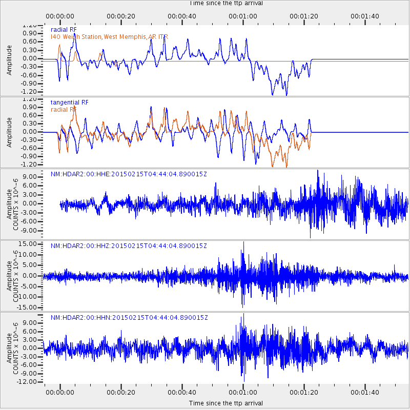
HDAR2 I40 Weigh Station,West Memphis,AR - Earthquake Result Viewer
*The percent match for this event was below the threshold and hence no stack was calculated.
| Earthquake location: |
Reykjanes Ridge |
| Earthquake latitude/longitude: |
52.7/-33.5 |
| Earthquake time(UTC): |
2015/02/15 (046) 04:36:35 GMT |
| Earthquake Depth: |
10 km |
| Earthquake Magnitude: |
5.0 MW |
| Earthquake Catalog/Contributor: |
ISC/ISC |
|
| Network: |
NM Cooperative New Madrid Seismic Network |
| Station: |
HDAR2 I40 Weigh Station,West Memphis,AR |
| Lat/Lon: |
35.15 N/90.09 W |
| Elevation: |
100 m |
|
| Distance: |
43.1 deg |
| Az: |
269.196 deg |
| Baz: |
47.955 deg |
| Ray Param: |
$rayparam |
*The percent match for this event was below the threshold and hence was not used in the summary stack. |
|
| Radial Match: |
54.42688 % |
| Radial Bump: |
400 |
| Transverse Match: |
42.373585 % |
| Transverse Bump: |
286 |
| SOD ConfigId: |
7019011 |
| Insert Time: |
2019-04-16 20:07:03.095 +0000 |
| GWidth: |
2.5 |
| Max Bumps: |
400 |
| Tol: |
0.001 |
|
Signal To Noise
| Channel | StoN | STA | LTA |
| NM:HDAR2:00:HHZ:20150215T04:44:04.890015Z | 1.7562418 | 1.3265056E-6 | 7.553092E-7 |
| NM:HDAR2:00:HHN:20150215T04:44:04.890015Z | 1.0805355 | 1.6767756E-6 | 1.5518004E-6 |
| NM:HDAR2:00:HHE:20150215T04:44:04.890015Z | 1.1197256 | 1.4020469E-6 | 1.2521344E-6 |
| Arrivals |
| Ps | |
| PpPs | |
| PsPs/PpSs | |


