You are here: Home > Network List > TA - USArray Transportable Network (new EarthScope stations) Stations List
> Station G59A Clarenceville, QC, USA > Earthquake Result Viewer
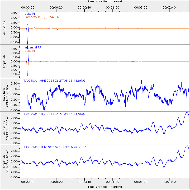
G59A Clarenceville, QC, USA - Earthquake Result Viewer
*The percent match for this event was below the threshold and hence no stack was calculated.
| Earthquake location: |
Iran-Iraq Border Region |
| Earthquake latitude/longitude: |
32.7/46.9 |
| Earthquake time(UTC): |
2015/02/15 (046) 08:04:41 GMT |
| Earthquake Depth: |
32 km |
| Earthquake Magnitude: |
4.9 MW |
| Earthquake Catalog/Contributor: |
ISC/ISC |
|
| Network: |
TA USArray Transportable Network (new EarthScope stations) |
| Station: |
G59A Clarenceville, QC, USA |
| Lat/Lon: |
45.08 N/73.18 W |
| Elevation: |
36 m |
|
| Distance: |
85.4 deg |
| Az: |
322.065 deg |
| Baz: |
46.999 deg |
| Ray Param: |
$rayparam |
*The percent match for this event was below the threshold and hence was not used in the summary stack. |
|
| Radial Match: |
99.265045 % |
| Radial Bump: |
31 |
| Transverse Match: |
99.7819 % |
| Transverse Bump: |
23 |
| SOD ConfigId: |
7019011 |
| Insert Time: |
2019-04-16 20:16:00.672 +0000 |
| GWidth: |
2.5 |
| Max Bumps: |
400 |
| Tol: |
0.001 |
|
Signal To Noise
| Channel | StoN | STA | LTA |
| TA:G59A: :HHZ:20150215T08:16:44.960Z | 0.7571932 | 2.024921E-6 | 2.6742464E-6 |
| TA:G59A: :HHN:20150215T08:16:44.960Z | 0.7817778 | 3.7426805E-6 | 4.787397E-6 |
| TA:G59A: :HHE:20150215T08:16:44.960Z | 0.34439015 | 7.995057E-8 | 2.3215114E-7 |
| Arrivals |
| Ps | |
| PpPs | |
| PsPs/PpSs | |


