You are here: Home > Network List > TA - USArray Transportable Network (new EarthScope stations) Stations List
> Station H17A Grant Village (NPS), Yellowstone Nt. Park, WY, USA > Earthquake Result Viewer
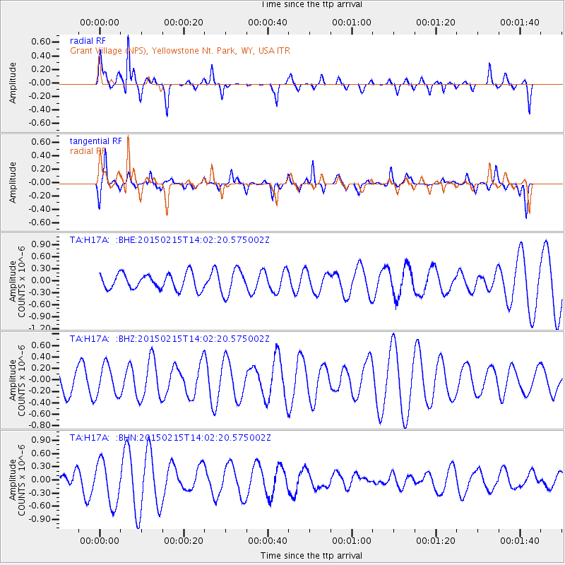
H17A Grant Village (NPS), Yellowstone Nt. Park, WY, USA - Earthquake Result Viewer
*The percent match for this event was below the threshold and hence no stack was calculated.
| Earthquake location: |
Fiji Islands Region |
| Earthquake latitude/longitude: |
-18.4/176.9 |
| Earthquake time(UTC): |
2015/02/15 (046) 13:49:52 GMT |
| Earthquake Depth: |
35 km |
| Earthquake Magnitude: |
5.5 MW |
| Earthquake Catalog/Contributor: |
ISC/ISC |
|
| Network: |
TA USArray Transportable Network (new EarthScope stations) |
| Station: |
H17A Grant Village (NPS), Yellowstone Nt. Park, WY, USA |
| Lat/Lon: |
44.40 N/110.58 W |
| Elevation: |
2400 m |
|
| Distance: |
90.9 deg |
| Az: |
43.154 deg |
| Baz: |
244.935 deg |
| Ray Param: |
$rayparam |
*The percent match for this event was below the threshold and hence was not used in the summary stack. |
|
| Radial Match: |
80.25004 % |
| Radial Bump: |
385 |
| Transverse Match: |
57.861618 % |
| Transverse Bump: |
354 |
| SOD ConfigId: |
7019011 |
| Insert Time: |
2019-04-16 20:36:08.563 +0000 |
| GWidth: |
2.5 |
| Max Bumps: |
400 |
| Tol: |
0.001 |
|
Signal To Noise
| Channel | StoN | STA | LTA |
| TA:H17A: :BHZ:20150215T14:02:20.575002Z | 1.2428871 | 2.6007552E-7 | 2.092511E-7 |
| TA:H17A: :BHN:20150215T14:02:20.575002Z | 2.5307915 | 5.069443E-7 | 2.0031057E-7 |
| TA:H17A: :BHE:20150215T14:02:20.575002Z | 1.6649013 | 3.2102642E-7 | 1.928201E-7 |
| Arrivals |
| Ps | |
| PpPs | |
| PsPs/PpSs | |


