You are here: Home > Network List > TA - USArray Transportable Network (new EarthScope stations) Stations List
> Station O03E Paynes Creek, CA, USA > Earthquake Result Viewer
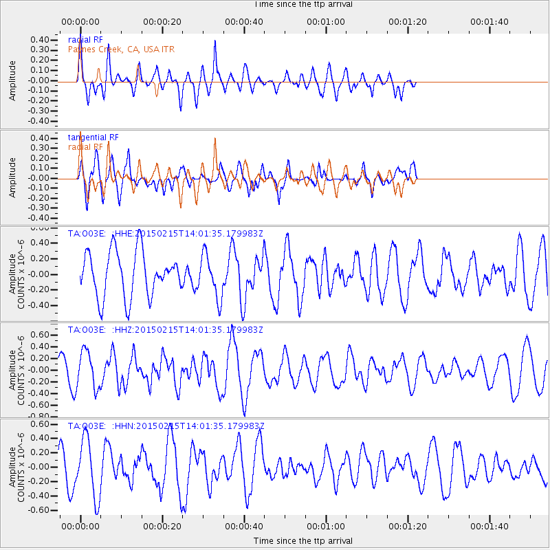
O03E Paynes Creek, CA, USA - Earthquake Result Viewer
*The percent match for this event was below the threshold and hence no stack was calculated.
| Earthquake location: |
Fiji Islands Region |
| Earthquake latitude/longitude: |
-18.4/176.9 |
| Earthquake time(UTC): |
2015/02/15 (046) 13:49:52 GMT |
| Earthquake Depth: |
35 km |
| Earthquake Magnitude: |
5.5 MW |
| Earthquake Catalog/Contributor: |
ISC/ISC |
|
| Network: |
TA USArray Transportable Network (new EarthScope stations) |
| Station: |
O03E Paynes Creek, CA, USA |
| Lat/Lon: |
40.29 N/121.80 W |
| Elevation: |
967 m |
|
| Distance: |
81.6 deg |
| Az: |
42.715 deg |
| Baz: |
237.354 deg |
| Ray Param: |
$rayparam |
*The percent match for this event was below the threshold and hence was not used in the summary stack. |
|
| Radial Match: |
50.60289 % |
| Radial Bump: |
400 |
| Transverse Match: |
71.23939 % |
| Transverse Bump: |
400 |
| SOD ConfigId: |
7019011 |
| Insert Time: |
2019-04-16 20:36:13.663 +0000 |
| GWidth: |
2.5 |
| Max Bumps: |
400 |
| Tol: |
0.001 |
|
Signal To Noise
| Channel | StoN | STA | LTA |
| TA:O03E: :HHZ:20150215T14:01:35.179983Z | 2.4087505 | 3.1789207E-7 | 1.3197385E-7 |
| TA:O03E: :HHN:20150215T14:01:35.179983Z | 2.2393544 | 4.169698E-7 | 1.8620091E-7 |
| TA:O03E: :HHE:20150215T14:01:35.179983Z | 0.9801585 | 2.8267618E-7 | 2.8839844E-7 |
| Arrivals |
| Ps | |
| PpPs | |
| PsPs/PpSs | |


